Le score de décrépitude est calculé en prenant en compte plusieurs facteurs, avec une pondération plus importante pour la différence de nombre de mots :
Facteur
Valeur
Poids
Contribution
Différence de date (en jours)
193
20%
38.6
Différence de nombre de mots
18
45%
0.09
Différence de nombre de sections
-2
15%
0.3
Différence de nombre de liens
28
10%
0.42
Différence de nombre d'images
-14
10%
0.28
Score total
39.69
Comment interpréter ce score :
Plus le score est élevé, plus la page française est considérée comme "décrépite" par rapport à la version anglaise.
La différence de nombre de mots compte pour 50% du score, car c'est l'indicateur le plus important de la complétude de la traduction.
Les différences de sections (15%), de liens (15%) et de date de modification (20%) complètent le score.
== Contents ==
== Usage ==
==== Common landuse key values - developed land ====
==== Common landuse key values - rural and agricultural land ====
==== Common landuse key values - waterbody ====
==== Other landuse key values ====
=== Personal tools ===
=== Namespaces ===
=== Views ===
=== Search ===
=== Site ===
=== Tools ===
=== In other projects ===
== Values == (EN only)
== Possible tagging mistakes == (EN only)
=== In other languages === (EN only)
Help - https://wiki.openstreetmap.org/wiki/Wiki_Translation
čeština - https://wiki.openstreetmap.org/wiki/Cs:Key:landuse
Deutsch - https://wiki.openstreetmap.org/wiki/DE:Key:landuse
español - https://wiki.openstreetmap.org/wiki/ES:Key:landuse
italiano - https://wiki.openstreetmap.org/wiki/IT:Key:landuse
magyar - https://wiki.openstreetmap.org/wiki/Hu:Key:landuse
Nederlands - https://wiki.openstreetmap.org/wiki/NL:Key:landuse
polski - https://wiki.openstreetmap.org/wiki/Pl:Key:landuse
português - https://wiki.openstreetmap.org/wiki/Pt:Key:landuse
русский - https://wiki.openstreetmap.org/wiki/RU:Key:landuse
українська - https://wiki.openstreetmap.org/wiki/Uk:Key:landuse
한국어 - https://wiki.openstreetmap.org/wiki/Ko:Key:landuse
中文(简体) - https://wiki.openstreetmap.org/wiki/Zh-hans:Key:landuse
日本語 - https://wiki.openstreetmap.org/wiki/JA:Key:landuse
Other languages... - #top
v - https://wiki.openstreetmap.org/wiki/Template:KeyDescription
d - https://wiki.openstreetmap.org/wiki/Template_talk:KeyDescription
landuse - https://taginfo.openstreetmap.org/keys/landuse
More details at taginfo - https://taginfo.openstreetmap.org/tags/natural%3Dfarmland
Taginfo - https://wiki.openstreetmap.org/wiki/Taginfo
AD - https://taginfo.geofabrik.de/europe/andorra/keys/landuse
AT - https://taginfo.geofabrik.de/europe/austria/keys/landuse
BR - https://taginfo.geofabrik.de/south-america/brazil/keys/landuse
BY - https://taginfo.geofabrik.de/europe/belarus/keys/landuse
CH - https://wiki.openstreetmap.org//taginfo.osm.ch/keys/landuse
CN - https://taginfo.geofabrik.de/asia/china/keys/landuse
CZ - http://taginfo.openstreetmap.cz/keys/landuse
DE - https://taginfo.geofabrik.de/europe/germany/keys/landuse
DK - https://taginfo.geofabrik.de/europe/denmark/keys/landuse
FI - https://taginfo.geofabrik.de/europe/finland/keys/landuse
FR - https://wiki.openstreetmap.org//taginfo.openstreetmap.fr/keys/landuse
GB - http://taginfo.openstreetmap.org.uk/keys/landuse
GR - https://taginfo.geofabrik.de/europe/greece/keys/landuse
HU - http://taginfo.openstreetmap.hu/keys/landuse
IN - https://wiki.openstreetmap.org//taginfo.openstreetmap.in/keys/landuse
IR - https://taginfo.geofabrik.de/asia/iran/keys/landuse
IT - https://taginfo.geofabrik.de/europe/italy/keys/landuse
LI - https://taginfo.geofabrik.de/europe/liechtenstein/keys/landuse
LU - https://taginfo.geofabrik.de/europe/luxembourg/keys/landuse
JP - https://taginfo.openstreetmap.jp/keys/landuse
KP - https://taginfo.geofabrik.de/asia/north-korea/keys/landuse
KR - https://taginfo.geofabrik.de/asia/south-korea/keys/landuse
NL - https://taginfo.geofabrik.de/europe/netherlands/keys/landuse
PL - http://taginfo.openstreetmap.pl/keys/landuse
PT - https://taginfo.geofabrik.de/europe/portugal/keys/landuse
RU - https://taginfo.geofabrik.de/russia/keys/landuse
ES - https://wiki.openstreetmap.org//taginfo.geofabrik.de/europe/spain/keys/landuse
AR - https://wiki.openstreetmap.org//taginfo.geofabrik.de/south-america/argentina/keys/landuse
MX - https://wiki.openstreetmap.org//taginfo.geofabrik.de/north-america/mexico/keys/landuse
CO - https://wiki.openstreetmap.org//taginfo.geofabrik.de/south-america/colombia/keys/landuse
BO - https://wiki.openstreetmap.org//taginfo.geofabrik.de/south-america/bolivia/keys/landuse
CL - https://wiki.openstreetmap.org//taginfo.geofabrik.de/south-america/chile/keys/landuse
EC - https://wiki.openstreetmap.org//taginfo.geofabrik.de/south-america/ecuador/keys/landuse
PY - https://wiki.openstreetmap.org//taginfo.geofabrik.de/south-america/paraguay/keys/landuse
PE - https://wiki.openstreetmap.org//taginfo.geofabrik.de/south-america/peru/keys/landuse
UY - https://wiki.openstreetmap.org//taginfo.geofabrik.de/south-america/uruguay/keys/landuse
VE - https://wiki.openstreetmap.org//taginfo.geofabrik.de/south-america/venezuela/keys/landuse
TW - https://taginfo.geofabrik.de/asia/taiwan/keys/landuse
UA - https://taginfo.geofabrik.de/europe/ukraine/keys/landuse
US - https://taginfo.geofabrik.de/north-america/us/keys/landuse
VN - https://taginfo.geofabrik.de/asia/vietnam/keys/landuse
overpass-turbo - https://overpass-turbo.eu/?template=key&key=landuse
OSM Tag History - https://taghistory.raifer.tech/#***/landuse/
1Usage - #Usage
Land use and areas of natural land - https://wiki.openstreetmap.org/wiki/Land_use_and_areas_of_natural_land
Landcover - https://wiki.openstreetmap.org/wiki/Landcover
amenity - https://wiki.openstreetmap.org/wiki/Key:amenity
leisure - https://taginfo.openstreetmap.org/tags/landuse%3Dleisure
tourism - https://wiki.openstreetmap.org/wiki/Key:tourism
college - https://wiki.openstreetmap.org/wiki/Tag:amenity%3Dcollege
hospital - https://wiki.openstreetmap.org/wiki/Tag:amenity%3Dhospital
park - https://wiki.openstreetmap.org/wiki/Tag:leisure%3Dpark
parking - https://wiki.openstreetmap.org/wiki/Tag:amenity%3Dparking
pitch - https://wiki.openstreetmap.org/wiki/Tag:leisure%3Dpitch
school - https://wiki.openstreetmap.org/wiki/Tag:amenity%3Dschool
swimming_pool - https://wiki.openstreetmap.org/wiki/Tag:amenity%3Dswimming_pool
university - https://wiki.openstreetmap.org/wiki/Tag:amenity%3Duniversity
flowerbed - https://wiki.openstreetmap.org/wiki/Tag:landuse%3Dflowerbed
grass - https://wiki.openstreetmap.org/wiki/Tag:natural%3Dgrass
Forest - https://wiki.openstreetmap.org/wiki/Forest
commercial - https://wiki.openstreetmap.org/wiki/Tag:landuse%3Dcommercial
retail - https://wiki.openstreetmap.org/wiki/Tag:landuse%3Dretail
construction - https://wiki.openstreetmap.org/wiki/Tag:landuse%3Dconstruction
education - https://wiki.openstreetmap.org/wiki/Tag:landuse%3Deducation
fairground - https://wiki.openstreetmap.org/wiki/Tag:landuse%3Dfairground
industrial - https://wiki.openstreetmap.org/wiki/Key:industrial
residential - https://wiki.openstreetmap.org/wiki/Tag:landuse%3Dresidential
institutional - https://wiki.openstreetmap.org/wiki/Tag:landuse%3Dinstitutional
office - https://wiki.openstreetmap.org/wiki/Key:office
government - https://wiki.openstreetmap.org/wiki/Tag:office%3Dgovernment
ngo - https://wiki.openstreetmap.org/wiki/Tag:office%3Dngo
association - https://wiki.openstreetmap.org/wiki/Tag:office%3Dassociation
social_facility - https://wiki.openstreetmap.org/wiki/Tag:amenity%3Dsocial_facility
civic_admin - https://wiki.openstreetmap.org/wiki/Tag:landuse%3Dcivic_admin
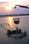
Aquaculture - https://en.wikipedia.org/wiki/en:Aquaculture
natural - https://wiki.openstreetmap.org/wiki/Key:natural
water - https://wiki.openstreetmap.org/wiki/Key:water
allotments - https://wiki.openstreetmap.org/wiki/Tag:landuse%3Dallotments
farmland - https://taginfo.openstreetmap.org/tags/natural%3Dfarmland
farmyard - https://wiki.openstreetmap.org/wiki/Tag:landuse%3Dfarmyard
paddy - https://wiki.openstreetmap.org/wiki/Tag:landuse%3Dpaddy
animal_keeping - https://wiki.openstreetmap.org/wiki/Tag:landuse%3Danimal_keeping
logging - https://wiki.openstreetmap.org/wiki/Tag:landuse%3Dlogging
greenhouse_horticulture - https://wiki.openstreetmap.org/wiki/Tag:landuse%3Dgreenhouse_horticulture
meadow - https://wiki.openstreetmap.org/wiki/Tag:natural%3Dmeadow
orchard - https://taginfo.openstreetmap.org/tags/natural%3Dorchard
plant_nursery - https://wiki.openstreetmap.org/wiki/Tag:landuse%3Dplant_nursery
vineyard - https://wiki.openstreetmap.org/wiki/Tag:landuse%3Dvineyard
basin - https://taginfo.openstreetmap.org/tags/natural%3Dbasin
reservoir - https://wiki.openstreetmap.org/wiki/Tag:water%3Dreservoir
salt_pond - https://wiki.openstreetmap.org/wiki/Tag:landuse%3Dsalt_pond
brownfield - https://wiki.openstreetmap.org/wiki/Tag:landuse%3Dbrownfield
cemetery - https://wiki.openstreetmap.org/wiki/Tag:landuse%3Dcemetery
religion - https://wiki.openstreetmap.org/wiki/Key:religion
grave_yard - https://wiki.openstreetmap.org/wiki/Tag:amenity%3Dgrave_yard
conservation - https://wiki.openstreetmap.org/wiki/Tag:landuse%3Dconservation
boundary - https://wiki.openstreetmap.org/wiki/Key:boundary
protected_area - https://wiki.openstreetmap.org/wiki/Key:protected_area
depot - https://wiki.openstreetmap.org/wiki/Tag:industrial%3Ddepot
railway - https://wiki.openstreetmap.org/wiki/Tag:landuse%3Drailway
garages - https://wiki.openstreetmap.org/wiki/Tag:landuse%3Dgarages
greenfield - https://wiki.openstreetmap.org/wiki/Tag:landuse%3Dgreenfield
landfill - https://wiki.openstreetmap.org/wiki/Tag:landuse%3Dlandfill
military - https://wiki.openstreetmap.org/wiki/Tag:landuse%3Dmilitary
port - https://wiki.openstreetmap.org/wiki/Tag:industrial%3Dport
quarry - https://wiki.openstreetmap.org/wiki/Tag:landuse%3Dquarry
recreation_ground - https://wiki.openstreetmap.org/wiki/Tag:landuse%3Drecreation_ground
religious - https://wiki.openstreetmap.org/wiki/Tag:landuse%3Dreligious
village_green - https://wiki.openstreetmap.org/wiki/Tag:landuse%3Dvillage_green
greenery - https://wiki.openstreetmap.org/wiki/Tag:landuse%3Dgreenery
winter_sports - https://wiki.openstreetmap.org/wiki/Tag:landuse%3Dwinter_sports
user defined - https://wiki.openstreetmap.org/wiki/Proposed_features
Editable here - https://wiki.openstreetmap.org/wiki/Template:Map_Features:landuse
yes - https://wiki.openstreetmap.org/wiki/Tag:landuse%3Dyes
land - https://taginfo.openstreetmap.org/keys/land
field - https://wiki.openstreetmap.org/wiki/Tag:landuse%3Dfield
agriculture - https://wiki.openstreetmap.org/wiki/Tag:landuse%3Dagriculture
proposed - https://taginfo.openstreetmap.org/tags/landuse%3Dproposed
français - https://wiki.openstreetmap.org/wiki/FR:Key:landuse (EN only)
elements - https://wiki.openstreetmap.org/wiki/Elements (EN only)
82 - https://wiki.openstreetmap.org/wiki/Category:Tag_descriptions_for_key_%22landuse%22 (EN only)
Status: - https://wiki.openstreetmap.org/wiki/Tag_status#Status_values (EN only)
2Values - #Values (EN only)
2.1Common landuse key values - developed land - #Common_landuse_key_values_-_developed_land (EN only)
2.2Common landuse key values - rural and agricultural land - #Common_landuse_key_values_-_rural_and_agricultural_land (EN only)
2.3Common landuse key values - waterbody - #Common_landuse_key_values_-_waterbody (EN only)
2.4Other landuse key values - #Other_landuse_key_values (EN only)
3Possible tagging mistakes - #Possible_tagging_mistakes (EN only)
Proposed features/landcover - https://wiki.openstreetmap.org/wiki/Proposed_features/landcover (EN only)
fair - https://en.wikipedia.org/wiki/fair (EN only)
Land use and areas of natural land#Open questions - https://wiki.openstreetmap.org/wiki/Land_use_and_areas_of_natural_land#Open_questions (EN only)
Institution (disambiguation) - https://en.wikipedia.org/wiki/en:Institution_(disambiguation) (EN only)
Other languages - http://www.omegawiki.org/DefinedMeaning:basin_(389120) (EN only)
Proposed features/Reservoir - https://wiki.openstreetmap.org/wiki/Proposed_features/Reservoir (EN only)
place of worship page - https://wiki.openstreetmap.org/wiki/Tag:amenity%3Dplace_of_worship (EN only)
All commonly used values - https://wiki.openstreetmap.org//taginfo.openstreetmap.org/keys/landuse#values (EN only)
places with this tag - https://overpass-turbo.eu/?w=%22natural%22%3D%22farmland%22+global&R (EN only)
you really know what you are doing - https://wiki.openstreetmap.org/wiki/Automated_Edits_code_of_conduct (EN only)
https://wiki.openstreetmap.org/w/index.php?title=Key:landuse&oldid=2818267 - https://wiki.openstreetmap.org/w/index.php?title=Key:landuse&oldid=2818267 (EN only)
== Contents ==
== Usage ==
==== Common landuse key values - developed land ====
==== Common landuse key values - rural and agricultural land ====
==== Common landuse key values - waterbody ====
==== Other landuse key values ====
=== Personal tools ===
=== Namespaces ===
=== Views ===
=== Search ===
=== Site ===
=== Tools ===
=== In other projects ===
==== Utilisation du terrain et couverture du terrain ==== (FR only)
== Principales valeurs == (FR only)
=== Type de terrain, usage (landuse) === (FR only)
== Éducation == (FR only)
== Erreurs d'étiquetages possibles == (FR only)
Help - https://wiki.openstreetmap.org/wiki/Wiki_Translation
čeština - https://wiki.openstreetmap.org/wiki/Cs:Key:landuse
Deutsch - https://wiki.openstreetmap.org/wiki/DE:Key:landuse
español - https://wiki.openstreetmap.org/wiki/ES:Key:landuse
italiano - https://wiki.openstreetmap.org/wiki/IT:Key:landuse
magyar - https://wiki.openstreetmap.org/wiki/Hu:Key:landuse
Nederlands - https://wiki.openstreetmap.org/wiki/NL:Key:landuse
polski - https://wiki.openstreetmap.org/wiki/Pl:Key:landuse
português - https://wiki.openstreetmap.org/wiki/Pt:Key:landuse
русский - https://wiki.openstreetmap.org/wiki/RU:Key:landuse
українська - https://wiki.openstreetmap.org/wiki/Uk:Key:landuse
한국어 - https://wiki.openstreetmap.org/wiki/Ko:Key:landuse
中文(简体) - https://wiki.openstreetmap.org/wiki/Zh-hans:Key:landuse
日本語 - https://wiki.openstreetmap.org/wiki/JA:Key:landuse
Other languages... - #top
v - https://wiki.openstreetmap.org/wiki/Template:KeyDescription
d - https://wiki.openstreetmap.org/wiki/Template_talk:KeyDescription
landuse - https://taginfo.openstreetmap.org/keys/landuse
More details at taginfo - https://taginfo.openstreetmap.org/tags/landuse%3Dproposed
Taginfo - https://wiki.openstreetmap.org/wiki/FR:Taginfo
AD - https://taginfo.geofabrik.de/europe/andorra/keys/landuse
AT - https://taginfo.geofabrik.de/europe/austria/keys/landuse
BR - https://taginfo.geofabrik.de/south-america/brazil/keys/landuse
BY - https://taginfo.geofabrik.de/europe/belarus/keys/landuse
CH - https://wiki.openstreetmap.org//taginfo.osm.ch/keys/landuse
CN - https://taginfo.geofabrik.de/asia/china/keys/landuse
CZ - http://taginfo.openstreetmap.cz/keys/landuse
DE - https://taginfo.geofabrik.de/europe/germany/keys/landuse
DK - https://taginfo.geofabrik.de/europe/denmark/keys/landuse
FI - https://taginfo.geofabrik.de/europe/finland/keys/landuse
FR - https://wiki.openstreetmap.org//taginfo.openstreetmap.fr/keys/landuse
GB - http://taginfo.openstreetmap.org.uk/keys/landuse
GR - https://taginfo.geofabrik.de/europe/greece/keys/landuse
HU - http://taginfo.openstreetmap.hu/keys/landuse
IN - https://wiki.openstreetmap.org//taginfo.openstreetmap.in/keys/landuse
IR - https://taginfo.geofabrik.de/asia/iran/keys/landuse
IT - https://taginfo.geofabrik.de/europe/italy/keys/landuse
LI - https://taginfo.geofabrik.de/europe/liechtenstein/keys/landuse
LU - https://taginfo.geofabrik.de/europe/luxembourg/keys/landuse
JP - https://taginfo.openstreetmap.jp/keys/landuse
KP - https://taginfo.geofabrik.de/asia/north-korea/keys/landuse
KR - https://taginfo.geofabrik.de/asia/south-korea/keys/landuse
NL - https://taginfo.geofabrik.de/europe/netherlands/keys/landuse
PL - http://taginfo.openstreetmap.pl/keys/landuse
PT - https://taginfo.geofabrik.de/europe/portugal/keys/landuse
RU - https://taginfo.geofabrik.de/russia/keys/landuse
ES - https://wiki.openstreetmap.org//taginfo.geofabrik.de/europe/spain/keys/landuse
AR - https://wiki.openstreetmap.org//taginfo.geofabrik.de/south-america/argentina/keys/landuse
MX - https://wiki.openstreetmap.org//taginfo.geofabrik.de/north-america/mexico/keys/landuse
CO - https://wiki.openstreetmap.org//taginfo.geofabrik.de/south-america/colombia/keys/landuse
BO - https://wiki.openstreetmap.org//taginfo.geofabrik.de/south-america/bolivia/keys/landuse
CL - https://wiki.openstreetmap.org//taginfo.geofabrik.de/south-america/chile/keys/landuse
EC - https://wiki.openstreetmap.org//taginfo.geofabrik.de/south-america/ecuador/keys/landuse
PY - https://wiki.openstreetmap.org//taginfo.geofabrik.de/south-america/paraguay/keys/landuse
PE - https://wiki.openstreetmap.org//taginfo.geofabrik.de/south-america/peru/keys/landuse
UY - https://wiki.openstreetmap.org//taginfo.geofabrik.de/south-america/uruguay/keys/landuse
VE - https://wiki.openstreetmap.org//taginfo.geofabrik.de/south-america/venezuela/keys/landuse
TW - https://taginfo.geofabrik.de/asia/taiwan/keys/landuse
UA - https://taginfo.geofabrik.de/europe/ukraine/keys/landuse
US - https://taginfo.geofabrik.de/north-america/us/keys/landuse
VN - https://taginfo.geofabrik.de/asia/vietnam/keys/landuse
overpass-turbo - https://overpass-turbo.eu/?template=key&key=landuse
OSM Tag History - https://taghistory.raifer.tech/#***/landuse/
1Usage - #Usage
Land use and areas of natural land - https://wiki.openstreetmap.org/wiki/Land_use_and_areas_of_natural_land
landcover - https://wiki.openstreetmap.org/wiki/Key:landcover
amenity - https://wiki.openstreetmap.org/wiki/FR:Key:amenity
leisure - https://taginfo.openstreetmap.org/tags/landuse%3Dleisure
tourism - https://wiki.openstreetmap.org/wiki/Key:tourism
college - https://wiki.openstreetmap.org/wiki/Tag:amenity%3Dcollege
hospital - https://wiki.openstreetmap.org/wiki/Tag:amenity%3Dhospital
park - https://wiki.openstreetmap.org/wiki/Tag:leisure%3Dpark
parking - https://wiki.openstreetmap.org/wiki/Tag:amenity%3Dparking
pitch - https://wiki.openstreetmap.org/wiki/Tag:leisure%3Dpitch
school - https://wiki.openstreetmap.org/wiki/Tag:amenity%3Dschool
swimming_pool - https://wiki.openstreetmap.org/wiki/Tag:amenity%3Dswimming_pool
university - https://wiki.openstreetmap.org/wiki/Tag:amenity%3Duniversity
flowerbed - https://wiki.openstreetmap.org/wiki/FR:Tag:landuse%3Dflowerbed
grass - https://wiki.openstreetmap.org/wiki/FR:Tag:landuse%3Dgrass
forest - https://wiki.openstreetmap.org/wiki/FR:Tag:landuse%3Dforest
commercial - https://wiki.openstreetmap.org/wiki/FR:Tag:landuse%3Dcommercial
retail - https://wiki.openstreetmap.org/wiki/FR:Tag:landuse%3Dretail
construction - https://wiki.openstreetmap.org/wiki/FR:Tag:landuse%3Dconstruction
education - https://wiki.openstreetmap.org/wiki/FR:Tag:landuse%3Deducation
fairground - https://wiki.openstreetmap.org/wiki/FR:Tag:landuse%3Dfairground
industrial - https://wiki.openstreetmap.org/wiki/FR:Key:industrial
residential - https://wiki.openstreetmap.org/wiki/FR:Tag:landuse%3Dresidential
institutional - https://wiki.openstreetmap.org/wiki/Tag:landuse%3Dinstitutional
office - https://wiki.openstreetmap.org/wiki/FR:Key:office
government - https://wiki.openstreetmap.org/wiki/FR:Tag:office%3Dgovernment
ngo - https://wiki.openstreetmap.org/wiki/FR:Tag:office%3Dngo
association - https://wiki.openstreetmap.org/wiki/FR:Tag:office%3Dassociation
social_facility - https://wiki.openstreetmap.org/wiki/FR:Tag:amenity%3Dsocial_facility
civic_admin - https://wiki.openstreetmap.org/wiki/Tag:landuse%3Dcivic_admin
Aquaculture - https://en.wikipedia.org/wiki/fr:Aquaculture
natural - https://wiki.openstreetmap.org/wiki/FR:Key:natural
water - https://wiki.openstreetmap.org/wiki/FR:Tag:natural%3Dwater
allotments - https://wiki.openstreetmap.org/wiki/FR:Tag:landuse%3Dallotments
farmland - https://wiki.openstreetmap.org/wiki/FR:Tag:landuse%3Dfarmland
farmyard - https://wiki.openstreetmap.org/wiki/FR:Tag:landuse%3Dfarmyard
paddy - https://wiki.openstreetmap.org/wiki/Tag:landuse%3Dpaddy
animal_keeping - https://wiki.openstreetmap.org/wiki/FR:Tag:landuse%3Danimal_keeping
logging - https://wiki.openstreetmap.org/wiki/Tag:landuse%3Dlogging
greenhouse_horticulture - https://wiki.openstreetmap.org/wiki/FR:Tag:landuse%3Dgreenhouse_horticulture
meadow - https://wiki.openstreetmap.org/wiki/FR:Tag:landuse%3Dmeadow
orchard - https://wiki.openstreetmap.org/wiki/FR:Tag:landuse%3Dorchard
plant_nursery - https://wiki.openstreetmap.org/wiki/FR:Tag:landuse%3Dplant_nursery
vineyard - https://wiki.openstreetmap.org/wiki/FR:Tag:landuse%3Dvineyard
basin - https://wiki.openstreetmap.org/wiki/FR:Key:basin
reservoir - https://wiki.openstreetmap.org/wiki/Tag:landuse%3Dreservoir
salt_pond - https://wiki.openstreetmap.org/wiki/FR:Tag:landuse%3Dsalt_pond
brownfield - https://wiki.openstreetmap.org/wiki/FR:Tag:landuse%3Dbrownfield
cemetery - https://wiki.openstreetmap.org/wiki/FR:Tag:landuse%3Dcemetery
religion - https://wiki.openstreetmap.org/wiki/FR:Key:religion
grave_yard - https://wiki.openstreetmap.org/wiki/FR:Tag:amenity%3Dgrave_yard
conservation - https://wiki.openstreetmap.org/wiki/Tag:landuse%3Dconservation
boundary - https://wiki.openstreetmap.org/wiki/FR:Key:boundary
protected_area - https://wiki.openstreetmap.org/wiki/Key:protected_area
depot - https://wiki.openstreetmap.org/wiki/Tag:industrial%3Ddepot
railway - https://wiki.openstreetmap.org/wiki/Tag:landuse%3Drailway
garages - https://wiki.openstreetmap.org/wiki/FR:Tag:landuse%3Dgarages
greenfield - https://wiki.openstreetmap.org/wiki/Tag:landuse%3Dgreenfield
landfill - https://wiki.openstreetmap.org/wiki/FR:Tag:landuse%3Dlandfill
military - https://wiki.openstreetmap.org/wiki/Tag:landuse%3Dmilitary
port - https://wiki.openstreetmap.org/wiki/Tag:industrial%3Dport
quarry - https://wiki.openstreetmap.org/wiki/FR:Tag:landuse%3Dquarry
recreation_ground - https://wiki.openstreetmap.org/wiki/Tag:landuse%3Drecreation_ground
religious - https://wiki.openstreetmap.org/wiki/FR:Tag:landuse%3Dreligious
village_green - https://wiki.openstreetmap.org/wiki/FR:Tag:landuse%3Dvillage_green
greenery - https://wiki.openstreetmap.org/wiki/Tag:landuse%3Dgreenery
winter_sports - https://wiki.openstreetmap.org/wiki/Tag:landuse%3Dwinter_sports
user defined - https://wiki.openstreetmap.org/wiki/FR:Proposed_features
Editable here - https://wiki.openstreetmap.org/wiki/Template:Map_Features:landuse
yes - https://wiki.openstreetmap.org/wiki/Tag:landuse%3Dyes
land - https://taginfo.openstreetmap.org/keys/land
field - https://wiki.openstreetmap.org/wiki/Tag:landuse%3Dfield
agriculture - https://wiki.openstreetmap.org/wiki/Tag:landuse%3Dagriculture
proposed - https://taginfo.openstreetmap.org/tags/landuse%3Dproposed
English - https://wiki.openstreetmap.org/wiki/Key:landuse (FR only)
Affectation du sol - https://wiki.openstreetmap.org/wiki/Category:FR:Affectation_du_sol (FR only)
éléments - https://wiki.openstreetmap.org/wiki/FR:%C3%89l%C3%A9ments (FR only)
Statut - https://wiki.openstreetmap.org/wiki/FR:Tag_status (FR only)
Key:natural - https://wiki.openstreetmap.org/wiki/Key:natural (FR only)
1.1Utilisation du terrain et couverture du terrain - #Utilisation_du_terrain_et_couverture_du_terrain (FR only)
2Principales valeurs - #Principales_valeurs (FR only)
2.1Type de terrain, usage (landuse) - #Type_de_terrain,_usage_(landuse) (FR only)
2.1.1Common landuse key values - developed land - #Common_landuse_key_values_-_developed_land (FR only)
2.1.2Common landuse key values - rural and agricultural land - #Common_landuse_key_values_-_rural_and_agricultural_land (FR only)
2.1.3Common landuse key values - waterbody - #Common_landuse_key_values_-_waterbody (FR only)
2.1.4Other landuse key values - #Other_landuse_key_values (FR only)
3Éducation - #Éducation (FR only)
4Erreurs d'étiquetages possibles - #Erreurs_d'étiquetages_possibles (FR only)
proposition de tag - https://wiki.openstreetmap.org/wiki/Proposed_features/landcover (FR only)
trees - https://wiki.openstreetmap.org/wiki/Tag:landcover%3Dtrees (FR only)
foire - https://fr.wikipedia.org/wiki/Foire_(%C3%A9conomie) (FR only)
Institution - https://en.wikipedia.org/wiki/fr:Institution (FR only)
Jardins familiaux - https://en.wikipedia.org/wiki/fr:Jardins_familiaux (FR only)
wood - https://wiki.openstreetmap.org/wiki/FR:Tag:natural%3Dwood (FR only)
man_made - https://wiki.openstreetmap.org/wiki/FR:Key:man_made (FR only)
reservoir_covered - https://wiki.openstreetmap.org/wiki/FR:Tag:man_made%3Dreservoir_covered (FR only)
Autres langues - http://www.omegawiki.org/DefinedMeaning:reservoir_(3196) (FR only)
place of worship - https://wiki.openstreetmap.org/wiki/FR:Tag:amenity%3Dplace_of_worship (FR only)
place_of_worship - https://wiki.openstreetmap.org/wiki/FR:Tag:amenity%3Dplace_of_worship (FR only)
les valeurs couramment utilisées - https://wiki.openstreetmap.org//taginfo.openstreetmap.org/keys/landuse#values (FR only)
éditée ici - https://wiki.openstreetmap.org/wiki/Template:FR:Map_Features:man_made (FR only)
FR:Tag:landuse=education - https://wiki.openstreetmap.org/wiki/FR:Tag:landuse%3Deducation (FR only)
endroits avec cet attribut - https://overpass-turbo.eu/?w=%22landuse%22%3D%22proposed%22+global&R (FR only)
vous ne sachiez vraiment ce que vous faites - https://wiki.openstreetmap.org/wiki/FR:Automated_Edits_code_of_conduct (FR only)
https://wiki.openstreetmap.org/w/index.php?title=FR:Key:landuse&oldid=2745823 - https://wiki.openstreetmap.org/w/index.php?title=FR:Key:landuse&oldid=2745823 (FR only)