Le score de décrépitude est calculé en prenant en compte plusieurs facteurs, avec une pondération plus importante pour la différence de nombre de mots :
Facteur
Valeur
Poids
Contribution
Différence de date (en jours)
95
20%
19
Différence de nombre de mots
-15
45%
0.08
Différence de nombre de sections
0
15%
0
Différence de nombre de liens
85
10%
1.28
Différence de nombre d'images
1
10%
0.02
Score total
20.37
Comment interpréter ce score :
Plus le score est élevé, plus la page française est considérée comme "décrépite" par rapport à la version anglaise.
La différence de nombre de mots compte pour 50% du score, car c'est l'indicateur le plus important de la complétude de la traduction.
Les différences de sections (15%), de liens (15%) et de date de modification (20%) complètent le score.
== Contents ==
==== When sidewalk/crosswalk is tagged as a separate way ====
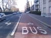
==== Busways tagged on the main roadway or lane (seeBus lanes) ====
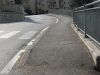
==== Street parking tagged on the main roadway (seeStreet parking) ====
=== Personal tools ===
=== Namespaces ===
=== Views ===
=== Search ===
=== Site ===
=== Tools ===
=== In other projects ===
== Usage == (EN only)
== Examples == (EN only)
== Values == (EN only)
=== Highway === (EN only)
==== Roads ==== (EN only)
==== Link roads ==== (EN only)
==== Special road types ==== (EN only)
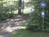
==== Paths ==== (EN only)
==== When sidewalk (or pavement) is tagged on the main roadway (seeSidewalks) ==== (EN only)
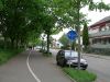
==== When cycleway is drawn as its own way (seeBicycle) ==== (EN only)
==== Cycleway tagged on the main roadway or lane (seeBicycle) ==== (EN only)
==== Lifecycle (see alsolifecycle prefixes) ==== (EN only)
==== Attributes ==== (EN only)
==== Other highway features ==== (EN only)
== Assumptions == (EN only)
== See also == (EN only)
== Possible tagging mistakes == (EN only)
=== In other languages === (EN only)
Help - https://wiki.openstreetmap.org/wiki/Wiki_Translation
brezhoneg - https://wiki.openstreetmap.org/wiki/Br:Key:highway
čeština - https://wiki.openstreetmap.org/wiki/Cs:Key:highway
Deutsch - https://wiki.openstreetmap.org/wiki/DE:Key:highway
eesti - https://wiki.openstreetmap.org/wiki/Et:Key:highway
español - https://wiki.openstreetmap.org/wiki/ES:Key:highway
italiano - https://wiki.openstreetmap.org/wiki/IT:Key:highway
latviešu - https://wiki.openstreetmap.org/wiki/Lv:Key:highway
magyar - https://wiki.openstreetmap.org/wiki/Hu:Key:highway
norsk - https://wiki.openstreetmap.org/wiki/No:Key:highway
occitan - https://wiki.openstreetmap.org/wiki/Oc:Key:highway
polski - https://wiki.openstreetmap.org/wiki/Pl:Key:highway
português - https://wiki.openstreetmap.org/wiki/Pt:Key:highway
shqip - https://wiki.openstreetmap.org/wiki/Sq:Key:highway
Tiếng Việt - https://wiki.openstreetmap.org/wiki/Vi:Key:highway
Türkçe - https://wiki.openstreetmap.org/wiki/Tr:Key:highway
русский - https://wiki.openstreetmap.org/wiki/RU:Key:highway
українська - https://wiki.openstreetmap.org/wiki/Uk:Key:highway
العربية - https://wiki.openstreetmap.org/wiki/Ar:Key:highway
فارسی - https://wiki.openstreetmap.org/wiki/Fa:Key:highway
한국어 - https://wiki.openstreetmap.org/wiki/Ko:Key:highway
中文(简体) - https://wiki.openstreetmap.org/wiki/Zh-hans:Key:highway
中文(繁體) - https://wiki.openstreetmap.org/wiki/Zh-hant:Key:highway
日本語 - https://wiki.openstreetmap.org/wiki/JA:Key:highway
粵語 - https://wiki.openstreetmap.org/wiki/Yue:Key:highway
Other languages... - #top
v - https://wiki.openstreetmap.org/wiki/Template:Highways
d - https://wiki.openstreetmap.org/wiki/Template_talk:Highways
highway - https://taginfo.openstreetmap.org/keys/highway
More details at taginfo - https://taginfo.openstreetmap.org/keys/road
Taginfo - https://wiki.openstreetmap.org/wiki/Taginfo
AD - https://taginfo.geofabrik.de/europe/andorra/keys/highway
AT - https://taginfo.geofabrik.de/europe/austria/keys/highway
BR - https://taginfo.geofabrik.de/south-america/brazil/keys/highway
BY - https://taginfo.geofabrik.de/europe/belarus/keys/highway
CH - https://wiki.openstreetmap.org//taginfo.osm.ch/keys/highway
CN - https://taginfo.geofabrik.de/asia/china/keys/highway
CZ - http://taginfo.openstreetmap.cz/keys/highway
DE - https://taginfo.geofabrik.de/europe/germany/keys/highway
DK - https://taginfo.geofabrik.de/europe/denmark/keys/highway
FI - https://taginfo.geofabrik.de/europe/finland/keys/highway
FR - https://wiki.openstreetmap.org//taginfo.openstreetmap.fr/keys/highway
GB - http://taginfo.openstreetmap.org.uk/keys/highway
GR - https://taginfo.geofabrik.de/europe/greece/keys/highway
HU - http://taginfo.openstreetmap.hu/keys/highway
IN - https://wiki.openstreetmap.org//taginfo.openstreetmap.in/keys/highway
IR - https://taginfo.geofabrik.de/asia/iran/keys/highway
IT - https://taginfo.geofabrik.de/europe/italy/keys/highway
LI - https://taginfo.geofabrik.de/europe/liechtenstein/keys/highway
LU - https://taginfo.geofabrik.de/europe/luxembourg/keys/highway
JP - https://taginfo.openstreetmap.jp/keys/highway
KP - https://taginfo.geofabrik.de/asia/north-korea/keys/highway
KR - https://taginfo.geofabrik.de/asia/south-korea/keys/highway
NL - https://taginfo.geofabrik.de/europe/netherlands/keys/highway
PL - http://taginfo.openstreetmap.pl/keys/highway
PT - https://taginfo.geofabrik.de/europe/portugal/keys/highway
RU - https://taginfo.geofabrik.de/russia/keys/highway
ES - https://wiki.openstreetmap.org//taginfo.geofabrik.de/europe/spain/keys/highway
AR - https://wiki.openstreetmap.org//taginfo.geofabrik.de/south-america/argentina/keys/highway
MX - https://wiki.openstreetmap.org//taginfo.geofabrik.de/north-america/mexico/keys/highway
CO - https://wiki.openstreetmap.org//taginfo.geofabrik.de/south-america/colombia/keys/highway
BO - https://wiki.openstreetmap.org//taginfo.geofabrik.de/south-america/bolivia/keys/highway
CL - https://wiki.openstreetmap.org//taginfo.geofabrik.de/south-america/chile/keys/highway
EC - https://wiki.openstreetmap.org//taginfo.geofabrik.de/south-america/ecuador/keys/highway
PY - https://wiki.openstreetmap.org//taginfo.geofabrik.de/south-america/paraguay/keys/highway
PE - https://wiki.openstreetmap.org//taginfo.geofabrik.de/south-america/peru/keys/highway
UY - https://wiki.openstreetmap.org//taginfo.geofabrik.de/south-america/uruguay/keys/highway
VE - https://wiki.openstreetmap.org//taginfo.geofabrik.de/south-america/venezuela/keys/highway
TW - https://taginfo.geofabrik.de/asia/taiwan/keys/highway
UA - https://taginfo.geofabrik.de/europe/ukraine/keys/highway
US - https://taginfo.geofabrik.de/north-america/us/keys/highway
VN - https://taginfo.geofabrik.de/asia/vietnam/keys/highway
overpass-turbo - https://overpass-turbo.eu/?template=key&key=highway
OSM Tag History - https://taghistory.raifer.tech/#***/highway/
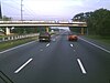
motorway - https://wiki.openstreetmap.org/wiki/Tag:highway%3Dmotorway
service - https://wiki.openstreetmap.org/wiki/Tag:highway%3Dservice
trunk - https://wiki.openstreetmap.org/wiki/Tag:highway%3Dtrunk
primary - https://wiki.openstreetmap.org/wiki/Tag:highway%3Dprimary
secondary - https://wiki.openstreetmap.org/wiki/Tag:highway%3Dsecondary
tertiary - https://wiki.openstreetmap.org/wiki/Tag:highway%3Dtertiary
unclassified - https://wiki.openstreetmap.org/wiki/Tag:highway%3Dunclassified
road - https://wiki.openstreetmap.org/wiki/Tag:highway%3Droad
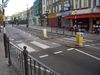
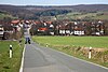
residential - https://wiki.openstreetmap.org/wiki/Tag:highway%3Dresidential
motorway_link - https://wiki.openstreetmap.org/wiki/Tag:highway%3Dmotorway_link
trunk_link - https://wiki.openstreetmap.org/wiki/Tag:highway%3Dtrunk_link
primary_link - https://wiki.openstreetmap.org/wiki/Tag:highway%3Dprimary_link
secondary_link - https://wiki.openstreetmap.org/wiki/Tag:highway%3Dsecondary_link
tertiary_link - https://wiki.openstreetmap.org/wiki/Tag:highway%3Dtertiary_link
living_street - https://wiki.openstreetmap.org/wiki/Tag:highway%3Dliving_street
access - https://wiki.openstreetmap.org/wiki/Key:access
pedestrian - https://wiki.openstreetmap.org/wiki/Tag:highway%3Dpedestrian
area - https://wiki.openstreetmap.org/wiki/Key:area
track - https://wiki.openstreetmap.org/wiki/Tag:highway%3Dtrack
tracktype - https://wiki.openstreetmap.org/wiki/Key:tracktype
bus_guideway - https://wiki.openstreetmap.org/wiki/Tag:highway%3Dbus_guideway
psv - https://wiki.openstreetmap.org/wiki/Key:psv
escape - https://wiki.openstreetmap.org/wiki/Tag:highway%3Descape
raceway - https://wiki.openstreetmap.org/wiki/Tag:highway%3Draceway
busway - https://wiki.openstreetmap.org/wiki/Tag:highway%3Dbusway
footway - https://wiki.openstreetmap.org/wiki/Tag:highway%3Dfootway
bicycle - https://wiki.openstreetmap.org/wiki/Key:bicycle
incline - https://wiki.openstreetmap.org/wiki/Key:incline
bridleway - https://wiki.openstreetmap.org/wiki/Tag:highway%3Dbridleway
steps - https://wiki.openstreetmap.org/wiki/Tag:highway%3Dsteps
corridor - https://wiki.openstreetmap.org/wiki/Tag:highway%3Dcorridor
path - https://wiki.openstreetmap.org/wiki/Tag:highway%3Dpath
cycleway - https://wiki.openstreetmap.org/wiki/Tag:highway%3Dcycleway
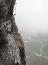
via_ferrata - https://wiki.openstreetmap.org/wiki/Tag:highway%3Dvia_ferrata
sidewalk - https://wiki.openstreetmap.org/wiki/Key:sidewalk
crossing - https://wiki.openstreetmap.org/wiki/Tag:highway%3Dcrossing
tactile_paving - https://wiki.openstreetmap.org/wiki/Key:tactile_paving
traffic_island - https://wiki.openstreetmap.org/wiki/Tag:footway%3Dtraffic_island
foot - https://wiki.openstreetmap.org/wiki/Key:foot
lane - https://wiki.openstreetmap.org/wiki/Tag:busway%3Dlane
opposite - https://wiki.openstreetmap.org/wiki/Tag:busway%3Dopposite
oneway - https://wiki.openstreetmap.org/wiki/Key:oneway
yes - https://wiki.openstreetmap.org/wiki/Tag:oneway%3Dyes
opposite_lane - https://wiki.openstreetmap.org/wiki/Tag:busway%3Dopposite_lane
cycleway:left - https://wiki.openstreetmap.org/wiki/Key:cycleway:left
cycleway:right - https://wiki.openstreetmap.org/wiki/Key:cycleway:right
cycleway:left:oneway - https://wiki.openstreetmap.org/wiki/Key:cycleway:left:oneway
cycleway:right:oneway - https://wiki.openstreetmap.org/wiki/Key:cycleway:right:oneway
opposite_track - https://wiki.openstreetmap.org/wiki/Tag:cycleway%3Dopposite_track
share_busway - https://wiki.openstreetmap.org/wiki/Tag:cycleway:right%3Dshare_busway
opposite_share_busway - https://wiki.openstreetmap.org/wiki/Tag:cycleway%3Dopposite_share_busway
shared_lane - https://wiki.openstreetmap.org/wiki/Tag:cycleway%3Dshared_lane
bus lanes - https://wiki.openstreetmap.org/wiki/Bus_lanes
lanes:bus - https://wiki.openstreetmap.org/wiki/Key:lanes:bus
lanes:psv - https://wiki.openstreetmap.org/wiki/Key:lanes:psv
bus:lanes - https://wiki.openstreetmap.org/wiki/Key:bus:lanes
psv:lanes - https://wiki.openstreetmap.org/wiki/Key:psv:lanes
oneway:bus - https://wiki.openstreetmap.org/wiki/Key:oneway:bus
street parking - https://wiki.openstreetmap.org/wiki/Street_parking
parking - https://wiki.openstreetmap.org/wiki/Key:parking
orientation - https://wiki.openstreetmap.org/wiki/Key:orientation
lifecycle prefixes - https://wiki.openstreetmap.org/wiki/Lifecycle_prefix
proposed - https://wiki.openstreetmap.org/wiki/Key:proposed
construction - https://wiki.openstreetmap.org/wiki/Tag:highway%3Dconstruction
abutters - https://wiki.openstreetmap.org/wiki/Key:abutters
bicycle_road - https://wiki.openstreetmap.org/wiki/Key:bicycle_road
bus_bay - https://wiki.openstreetmap.org/wiki/Key:bus_bay
change - https://wiki.openstreetmap.org/wiki/Key:change
destination - https://wiki.openstreetmap.org/wiki/Key:destination
embankment - https://wiki.openstreetmap.org/wiki/Key:embankment
embedded_rails - https://wiki.openstreetmap.org/wiki/Key:embedded_rails
yes | <type of railway> - https://wiki.openstreetmap.org/wiki/Key:embedded_rails
ford - https://wiki.openstreetmap.org/wiki/Key:ford
frontage_road - https://wiki.openstreetmap.org/wiki/Key:frontage_road
ice_road - https://wiki.openstreetmap.org/wiki/Key:ice_road
junction - https://wiki.openstreetmap.org/wiki/Key:junction
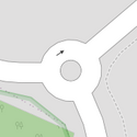
roundabout - https://wiki.openstreetmap.org/wiki/Tag:junction%3Droundabout
Lanes - https://wiki.openstreetmap.org/wiki/Lanes
lane_markings - https://wiki.openstreetmap.org/wiki/Key:lane_markings
lit - https://wiki.openstreetmap.org/wiki/Key:lit
maxspeed - https://wiki.openstreetmap.org/wiki/Key:maxspeed
motorroad - https://wiki.openstreetmap.org/wiki/Key:motorroad
mountain_pass - https://wiki.openstreetmap.org/wiki/Key:mountain_pass
mtb:scale - https://wiki.openstreetmap.org/wiki/Key:mtb:scale
mtb:description - https://wiki.openstreetmap.org/wiki/Key:mtb:description
oneway:bicycle - https://wiki.openstreetmap.org/wiki/Key:oneway:bicycle
overtaking - https://wiki.openstreetmap.org/wiki/Key:overtaking
parking:lane - https://wiki.openstreetmap.org/wiki/Key:parking:lane
parking:condition - https://wiki.openstreetmap.org/wiki/Key:parking:condition
passing_places - https://wiki.openstreetmap.org/wiki/Key:passing_places
passing_place - https://wiki.openstreetmap.org/wiki/Tag:highway%3Dpassing_place
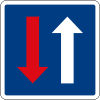
priority - https://wiki.openstreetmap.org/wiki/Key:priority
priority_road - https://wiki.openstreetmap.org/wiki/Key:priority_road
sac_scale - https://wiki.openstreetmap.org/wiki/Key:sac_scale
alley - https://wiki.openstreetmap.org/wiki/Tag:service%3Dalley
driveway - https://wiki.openstreetmap.org/wiki/Tag:service%3Ddriveway
parking_aisle - https://wiki.openstreetmap.org/wiki/Tag:service%3Dparking_aisle
shoulder - https://wiki.openstreetmap.org/wiki/Key:shoulder
side_road - https://wiki.openstreetmap.org/wiki/Key:side_road
smoothness - https://wiki.openstreetmap.org/wiki/Key:smoothness
Key:smoothness - https://wiki.openstreetmap.org/wiki/Key:smoothness
surface - https://wiki.openstreetmap.org/wiki/Key:surface
traffic_calming - https://wiki.openstreetmap.org/wiki/Key:traffic_calming
trail_visibility - https://wiki.openstreetmap.org/wiki/Key:trail_visibility
trailblazed - https://wiki.openstreetmap.org/wiki/Key:trailblazed
Key:trailblazed - https://wiki.openstreetmap.org/wiki/Key:trailblazed
trailblazed:visibility - https://wiki.openstreetmap.org/wiki/Key:trailblazed:visibility
Key:trailblazed:visibility - https://wiki.openstreetmap.org/wiki/Key:trailblazed:visibility
turn - https://wiki.openstreetmap.org/wiki/Key:turn
width - https://wiki.openstreetmap.org/wiki/Key:width
winter_road - https://wiki.openstreetmap.org/wiki/Key:winter_road
bus_stop - https://wiki.openstreetmap.org/wiki/Tag:highway%3Dbus_stop
public_transport - https://wiki.openstreetmap.org/wiki/Key:public_transport
platform - https://wiki.openstreetmap.org/wiki/Tag:highway%3Dplatform
cyclist_waiting_aid - https://wiki.openstreetmap.org/wiki/Tag:highway%3Dcyclist_waiting_aid
elevator - https://wiki.openstreetmap.org/wiki/Tag:highway%3Delevator
emergency_bay - https://wiki.openstreetmap.org/wiki/Tag:highway%3Demergency_bay
emergency_access_point - https://wiki.openstreetmap.org/wiki/Tag:highway%3Demergency_access_point
ref - https://wiki.openstreetmap.org/wiki/Key:ref
emergency - https://wiki.openstreetmap.org/wiki/Key:emergency
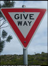
give_way - https://wiki.openstreetmap.org/wiki/Tag:highway%3Dgive_way
phone - https://wiki.openstreetmap.org/wiki/Tag:emergency%3Dphone
hitchhiking - https://wiki.openstreetmap.org/wiki/Tag:highway%3Dhitchhiking
ladder - https://wiki.openstreetmap.org/wiki/Tag:highway%3Dladder
milestone - https://wiki.openstreetmap.org/wiki/Tag:highway%3Dmilestone
mini_roundabout - https://wiki.openstreetmap.org/wiki/Tag:highway%3Dmini_roundabout
motorway_junction - https://wiki.openstreetmap.org/wiki/Tag:highway%3Dmotorway_junction
rest_area - https://wiki.openstreetmap.org/wiki/Tag:highway%3Drest_area
services - https://wiki.openstreetmap.org/wiki/Tag:highway%3Dservices
speed_camera - https://wiki.openstreetmap.org/wiki/Tag:highway%3Dspeed_camera
speed_display - https://wiki.openstreetmap.org/wiki/Tag:highway%3Dspeed_display
stop - https://wiki.openstreetmap.org/wiki/Tag:highway%3Dstop
street_lamp - https://wiki.openstreetmap.org/wiki/Tag:highway%3Dstreet_lamp
toll_gantry - https://wiki.openstreetmap.org/wiki/Tag:highway%3Dtoll_gantry
barrier - https://wiki.openstreetmap.org/wiki/Key:barrier
toll_booth - https://wiki.openstreetmap.org/wiki/Tag:barrier%3Dtoll_booth
traffic_mirror - https://wiki.openstreetmap.org/wiki/Tag:highway%3Dtraffic_mirror
traffic_signals - https://wiki.openstreetmap.org/wiki/Tag:highway%3Dtraffic_signals
trailhead - https://wiki.openstreetmap.org/wiki/Tag:highway%3Dtrailhead
turning_circle - https://wiki.openstreetmap.org/wiki/Tag:highway%3Dturning_circle
turning_loop - https://wiki.openstreetmap.org/wiki/Tag:highway%3Dturning_loop
User Defined - https://wiki.openstreetmap.org/wiki/Proposed_features
Editable here - https://wiki.openstreetmap.org/wiki/Template:Map_Features:highway
français - https://wiki.openstreetmap.org/wiki/FR:Key:highway (EN only)
Highways - https://wiki.openstreetmap.org/wiki/Highways (EN only)
elements - https://wiki.openstreetmap.org/wiki/Elements (EN only)
70 - https://wiki.openstreetmap.org/wiki/Category:Tag_descriptions_for_key_%22highway%22 (EN only)
Status: - https://wiki.openstreetmap.org/wiki/Tag_status#Status_values (EN only)
1Usage - #Usage (EN only)
2Examples - #Examples (EN only)
3Values - #Values (EN only)
3.1Highway - #Highway (EN only)
3.1.1Roads - #Roads (EN only)
3.1.2Link roads - #Link_roads (EN only)
3.1.3Special road types - #Special_road_types (EN only)
3.1.4Paths - #Paths (EN only)
3.1.5When sidewalk/crosswalk is tagged as a separate way - #When_sidewalk/crosswalk_is_tagged_as_a_separate_way (EN only)
3.1.6When sidewalk (or pavement) is tagged on the main roadway (see Sidewalks) - #When_sidewalk_(or_pavement)_is_tagged_on_the_main_roadway_(see_Sidewalks) (EN only)
3.1.7When cycleway is drawn as its own way (see Bicycle) - #When_cycleway_is_drawn_as_its_own_way_(see_Bicycle) (EN only)
3.1.8Cycleway tagged on the main roadway or lane (see Bicycle) - #Cycleway_tagged_on_the_main_roadway_or_lane_(see_Bicycle) (EN only)
3.1.9Busways tagged on the main roadway or lane (see Bus lanes) - #Busways_tagged_on_the_main_roadway_or_lane_(see_Bus_lanes) (EN only)
3.1.10Street parking tagged on the main roadway (see Street parking) - #Street_parking_tagged_on_the_main_roadway_(see_Street_parking) (EN only)
3.1.11Lifecycle (see also lifecycle prefixes) - #Lifecycle_(see_also_lifecycle_prefixes) (EN only)
3.1.12Attributes - #Attributes (EN only)
3.1.13Other highway features - #Other_highway_features (EN only)
4Assumptions - #Assumptions (EN only)
5See also - #See_also (EN only)
6Possible tagging mistakes - #Possible_tagging_mistakes (EN only)
international highway classification equivalence - https://wiki.openstreetmap.org/wiki/International_highway_classification_equivalence (EN only)
function and importance rather by their physical characteristic - https://wiki.openstreetmap.org/wiki/Proposed_features/Highway_key_voting_importance (EN only)
while it can be confusing - https://wiki.openstreetmap.org/wiki/Counterintuitive_keys_and_values#Multiple_meanings (EN only)
urban - https://wiki.openstreetmap.org/wiki/Highway_tagging_samples/urban (EN only)
Rendering carto - https://wiki.openstreetmap.org/wiki/Standard_tile_layer (EN only)
Link Roads - https://wiki.openstreetmap.org/wiki/Highway_link (EN only)
living streets - https://en.wikipedia.org/wiki/living_street (EN only)
generalhighwayvalues - #Roads (EN only)
step_count - https://wiki.openstreetmap.org/wiki/Key:step_count (EN only)
wheelchair - https://wiki.openstreetmap.org/wiki/Key:wheelchair (EN only)
kerb - https://wiki.openstreetmap.org/wiki/Key:kerb (EN only)
Sidewalks - https://wiki.openstreetmap.org/wiki/Sidewalks (EN only)
default-access-restrictions - https://wiki.openstreetmap.org/wiki/OSM_tags_for_routing/Access-Restrictions (EN only)
Key:abutters - https://wiki.openstreetmap.org/wiki/Key:abutters (EN only)
forward - https://wiki.openstreetmap.org/wiki/Key:forward (EN only)
backward - https://wiki.openstreetmap.org/wiki/Key:backward (EN only)
Key:service - https://wiki.openstreetmap.org/wiki/Key:service (EN only)
Key:surface - https://wiki.openstreetmap.org/wiki/Key:surface (EN only)
Key:tracktype - https://wiki.openstreetmap.org/wiki/Key:tracktype (EN only)
Key:traffic calming - https://wiki.openstreetmap.org/wiki/Key:traffic_calming (EN only)
stop_position - https://wiki.openstreetmap.org/wiki/Tag:public_transport%3Dstop_position (EN only)
access_point - https://wiki.openstreetmap.org/wiki/Tag:emergency%3Daccess_point (EN only)
traversable - https://wiki.openstreetmap.org/wiki/Traversable (EN only)
direction - https://wiki.openstreetmap.org/wiki/Key:direction (EN only)
anticlockwise - https://wiki.openstreetmap.org/wiki/Tag:direction%3Danticlockwise (EN only)
clockwise - https://wiki.openstreetmap.org/wiki/Tag:direction%3Dclockwise (EN only)
All commonly used values - https://wiki.openstreetmap.org//taginfo.openstreetmap.org/keys/highway#values (EN only)
Highway Tag Africa - https://wiki.openstreetmap.org/wiki/Highway_Tag_Africa (EN only)
asphalt - https://wiki.openstreetmap.org/wiki/Tag:surface%3Dasphalt (EN only)
grade1 - https://wiki.openstreetmap.org/wiki/Tag:tracktype%3Dgrade1 (EN only)
importance - https://wiki.openstreetmap.org/wiki/Proposed_features/Highway_key_voting_importance (EN only)
intended main use - https://wiki.openstreetmap.org/wiki/Tag:highway%3Dpath (EN only)
Africa - https://wiki.openstreetmap.org/wiki/Highway_Tag_Africa (EN only)
Statistics about tagged roads (length for each country with history, possibility to display info about specific road class) [Archived] - https://web.archive.org/web/20211027163459/https://osmstats.stevecoast.com/dashboard/ht/total (EN only)
places with this tag - https://overpass-turbo.eu/?w=%22road%22%3D%0A%2A+global&R (EN only)
you really know what you are doing - https://wiki.openstreetmap.org/wiki/Automated_Edits_code_of_conduct (EN only)
Roads - #Roads (EN only)
Special - #Special_road_types (EN only)
living street - https://wiki.openstreetmap.org/wiki/Tag:highway%3Dliving_street (EN only)
bicycle road - https://wiki.openstreetmap.org/wiki/Key:bicycle_road (EN only)
cyclestreet - https://wiki.openstreetmap.org/wiki/Key:cyclestreet (EN only)
bus guideway - https://wiki.openstreetmap.org/wiki/Tag:highway%3Dbus_guideway (EN only)
Paths - #Paths (EN only)
escalator - https://wiki.openstreetmap.org/wiki/Key:conveying (EN only)
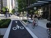
Special lanes - https://wiki.openstreetmap.org/wiki/Sidewalks (EN only)
cycleway lane - https://wiki.openstreetmap.org/wiki/Tag:cycleway%3Dlane (EN only)
cycleway tracks - https://wiki.openstreetmap.org/wiki/Tag:cycleway%3Dtrack (EN only)
bus and cyclists - https://wiki.openstreetmap.org/wiki/Tag:cycleway%3Dshare_busway (EN only)
number of lanes - https://wiki.openstreetmap.org/wiki/Key:lanes (EN only)
direction instructions ("turn lanes") - https://wiki.openstreetmap.org/wiki/Key:turn (EN only)
signposts - https://wiki.openstreetmap.org/wiki/Key:destination (EN only)
conditional restrictions - https://wiki.openstreetmap.org/wiki/Conditional_restrictions (EN only)
turn restrictions - https://wiki.openstreetmap.org/wiki/Relation:restriction (EN only)
highway tagging samples - https://wiki.openstreetmap.org/wiki/Highway_tagging_samples (EN only)
https://wiki.openstreetmap.org/w/index.php?title=Key:highway&oldid=2834591 - https://wiki.openstreetmap.org/w/index.php?title=Key:highway&oldid=2834591 (EN only)
== Contents ==
==== When sidewalk/crosswalk is tagged as a separate way ====
==== Busways tagged on the main roadway or lane (seeBus lanes) ====
==== Street parking tagged on the main roadway (seeStreet parking) ====
=== Personal tools ===
=== Namespaces ===
=== Views ===
=== Search ===
=== Site ===
=== Tools ===
=== In other projects ===
== Description == (FR only)
== Exceptions aux attributs physiques == (FR only)
== Le tag highway et les droits d'accès == (FR only)
== Itinéraires routiers. == (FR only)
== Voir aussi == (FR only)
== Valeurs == (FR only)
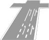
=== Route (highway) === (FR only)
==== Routes ==== (FR only)
==== Routes de liaison ==== (FR only)
==== Types de routes spéciales ==== (FR only)
==== Chemins ==== (FR only)
==== Lorsque le trottoir (ou la chaussée) est taggué(e) sur la chaussée principale (VoirTrottoirs) ==== (FR only)
==== Lorsque la piste cyclable est dessinée en tant que sa propre voie (VoirCyclisme) ==== (FR only)
==== Lorsque la piste cyclable est taguée sur la chaussée principale (VoirCyclisme) ==== (FR only)
==== Cycle de vie (voir égalementlifecycle prefixes) ==== (FR only)
==== Attributs ==== (FR only)
==== Autres ==== (FR only)
== Équivalence internationale == (FR only)
Help - https://wiki.openstreetmap.org/wiki/Wiki_Translation
brezhoneg - https://wiki.openstreetmap.org/wiki/Br:Key:highway
čeština - https://wiki.openstreetmap.org/wiki/Cs:Key:highway
Deutsch - https://wiki.openstreetmap.org/wiki/DE:Key:highway
eesti - https://wiki.openstreetmap.org/wiki/Et:Key:highway
español - https://wiki.openstreetmap.org/wiki/ES:Key:highway
italiano - https://wiki.openstreetmap.org/wiki/IT:Key:highway
latviešu - https://wiki.openstreetmap.org/wiki/Lv:Key:highway
magyar - https://wiki.openstreetmap.org/wiki/Hu:Key:highway
norsk - https://wiki.openstreetmap.org/wiki/No:Key:highway
occitan - https://wiki.openstreetmap.org/wiki/Oc:Key:highway
polski - https://wiki.openstreetmap.org/wiki/Pl:Key:highway
português - https://wiki.openstreetmap.org/wiki/Pt:Key:highway
shqip - https://wiki.openstreetmap.org/wiki/Sq:Key:highway
Tiếng Việt - https://wiki.openstreetmap.org/wiki/Vi:Key:highway
Türkçe - https://wiki.openstreetmap.org/wiki/Tr:Key:highway
русский - https://wiki.openstreetmap.org/wiki/RU:Key:highway
українська - https://wiki.openstreetmap.org/wiki/Uk:Key:highway
العربية - https://wiki.openstreetmap.org/wiki/Ar:Key:highway
فارسی - https://wiki.openstreetmap.org/wiki/Fa:Key:highway
한국어 - https://wiki.openstreetmap.org/wiki/Ko:Key:highway
中文(简体) - https://wiki.openstreetmap.org/wiki/Zh-hans:Key:highway
中文(繁體) - https://wiki.openstreetmap.org/wiki/Zh-hant:Key:highway
日本語 - https://wiki.openstreetmap.org/wiki/JA:Key:highway
粵語 - https://wiki.openstreetmap.org/wiki/Yue:Key:highway
Other languages... - #top
v - https://wiki.openstreetmap.org/wiki/Template:KeyDescription
d - https://wiki.openstreetmap.org/wiki/Template_talk:KeyDescription
highway - https://taginfo.openstreetmap.org/keys/highway
More details at taginfo - https://taginfo.openstreetmap.org/keys/highway
Taginfo - https://wiki.openstreetmap.org/wiki/FR:Taginfo
AD - https://taginfo.geofabrik.de/europe/andorra/keys/highway
AT - https://taginfo.geofabrik.de/europe/austria/keys/highway
BR - https://taginfo.geofabrik.de/south-america/brazil/keys/highway
BY - https://taginfo.geofabrik.de/europe/belarus/keys/highway
CH - https://wiki.openstreetmap.org//taginfo.osm.ch/keys/highway
CN - https://taginfo.geofabrik.de/asia/china/keys/highway
CZ - http://taginfo.openstreetmap.cz/keys/highway
DE - https://taginfo.geofabrik.de/europe/germany/keys/highway
DK - https://taginfo.geofabrik.de/europe/denmark/keys/highway
FI - https://taginfo.geofabrik.de/europe/finland/keys/highway
FR - https://wiki.openstreetmap.org//taginfo.openstreetmap.fr/keys/highway
GB - http://taginfo.openstreetmap.org.uk/keys/highway
GR - https://taginfo.geofabrik.de/europe/greece/keys/highway
HU - http://taginfo.openstreetmap.hu/keys/highway
IN - https://wiki.openstreetmap.org//taginfo.openstreetmap.in/keys/highway
IR - https://taginfo.geofabrik.de/asia/iran/keys/highway
IT - https://taginfo.geofabrik.de/europe/italy/keys/highway
LI - https://taginfo.geofabrik.de/europe/liechtenstein/keys/highway
LU - https://taginfo.geofabrik.de/europe/luxembourg/keys/highway
JP - https://taginfo.openstreetmap.jp/keys/highway
KP - https://taginfo.geofabrik.de/asia/north-korea/keys/highway
KR - https://taginfo.geofabrik.de/asia/south-korea/keys/highway
NL - https://taginfo.geofabrik.de/europe/netherlands/keys/highway
PL - http://taginfo.openstreetmap.pl/keys/highway
PT - https://taginfo.geofabrik.de/europe/portugal/keys/highway
RU - https://taginfo.geofabrik.de/russia/keys/highway
ES - https://wiki.openstreetmap.org//taginfo.geofabrik.de/europe/spain/keys/highway
AR - https://wiki.openstreetmap.org//taginfo.geofabrik.de/south-america/argentina/keys/highway
MX - https://wiki.openstreetmap.org//taginfo.geofabrik.de/north-america/mexico/keys/highway
CO - https://wiki.openstreetmap.org//taginfo.geofabrik.de/south-america/colombia/keys/highway
BO - https://wiki.openstreetmap.org//taginfo.geofabrik.de/south-america/bolivia/keys/highway
CL - https://wiki.openstreetmap.org//taginfo.geofabrik.de/south-america/chile/keys/highway
EC - https://wiki.openstreetmap.org//taginfo.geofabrik.de/south-america/ecuador/keys/highway
PY - https://wiki.openstreetmap.org//taginfo.geofabrik.de/south-america/paraguay/keys/highway
PE - https://wiki.openstreetmap.org//taginfo.geofabrik.de/south-america/peru/keys/highway
UY - https://wiki.openstreetmap.org//taginfo.geofabrik.de/south-america/uruguay/keys/highway
VE - https://wiki.openstreetmap.org//taginfo.geofabrik.de/south-america/venezuela/keys/highway
TW - https://taginfo.geofabrik.de/asia/taiwan/keys/highway
UA - https://taginfo.geofabrik.de/europe/ukraine/keys/highway
US - https://taginfo.geofabrik.de/north-america/us/keys/highway
VN - https://taginfo.geofabrik.de/asia/vietnam/keys/highway
overpass-turbo - https://overpass-turbo.eu/?template=key&key=highway
OSM Tag History - https://taghistory.raifer.tech/#***/highway/
motorway - https://wiki.openstreetmap.org/wiki/FR:Tag:highway%3Dmotorway
service - https://wiki.openstreetmap.org/wiki/FR:Tag:highway%3Dservice
trunk - https://wiki.openstreetmap.org/wiki/FR:Tag:highway%3Dtrunk
primary - https://wiki.openstreetmap.org/wiki/FR:Tag:highway%3Dprimary
secondary - https://wiki.openstreetmap.org/wiki/FR:Tag:highway%3Dsecondary
tertiary - https://wiki.openstreetmap.org/wiki/FR:Tag:highway%3Dtertiary
unclassified - https://wiki.openstreetmap.org/wiki/FR:Tag:highway%3Dunclassified
road - https://wiki.openstreetmap.org/wiki/FR:Tag:highway%3Droad
residential - https://wiki.openstreetmap.org/wiki/FR:Tag:highway%3Dresidential
motorway_link - https://wiki.openstreetmap.org/wiki/FR:Tag:highway%3Dmotorway_link
trunk_link - https://wiki.openstreetmap.org/wiki/Tag:highway%3Dtrunk_link
primary_link - https://wiki.openstreetmap.org/wiki/Tag:highway%3Dprimary_link
secondary_link - https://wiki.openstreetmap.org/wiki/Tag:highway%3Dsecondary_link
tertiary_link - https://wiki.openstreetmap.org/wiki/Tag:highway%3Dtertiary_link
living_street - https://wiki.openstreetmap.org/wiki/FR:Tag:highway%3Dliving_street
access - https://wiki.openstreetmap.org/wiki/FR:Key:access
pedestrian - https://wiki.openstreetmap.org/wiki/FR:Tag:highway%3Dpedestrian
area - https://wiki.openstreetmap.org/wiki/FR:Key:area
track - https://wiki.openstreetmap.org/wiki/FR:Tag:highway%3Dtrack
tracktype - https://wiki.openstreetmap.org/wiki/FR:Key:tracktype
bus_guideway - https://wiki.openstreetmap.org/wiki/FR:Tag:highway%3Dbus_guideway
psv - https://wiki.openstreetmap.org/wiki/FR:Key:psv
escape - https://wiki.openstreetmap.org/wiki/FR:Tag:highway%3Descape
raceway - https://wiki.openstreetmap.org/wiki/FR:Tag:highway%3Draceway
busway - https://wiki.openstreetmap.org/wiki/FR:Key:busway
footway - https://wiki.openstreetmap.org/wiki/FR:Tag:highway%3Dfootway
bicycle - https://wiki.openstreetmap.org/wiki/FR:Key:bicycle
incline - https://wiki.openstreetmap.org/wiki/FR:Key:incline
bridleway - https://wiki.openstreetmap.org/wiki/FR:Tag:highway%3Dbridleway
steps - https://wiki.openstreetmap.org/wiki/FR:Tag:highway%3Dsteps
corridor - https://wiki.openstreetmap.org/wiki/Tag:highway%3Dcorridor
path - https://wiki.openstreetmap.org/wiki/FR:Tag:highway%3Dpath
cycleway - https://wiki.openstreetmap.org/wiki/FR:Tag:highway%3Dcycleway
via_ferrata - https://wiki.openstreetmap.org/wiki/Tag:highway%3Dvia_ferrata
sidewalk - https://wiki.openstreetmap.org/wiki/FR:Key:sidewalk
crossing - https://wiki.openstreetmap.org/wiki/FR:Tag:highway%3Dcrossing
tactile_paving - https://wiki.openstreetmap.org/wiki/FR:Key:tactile_paving
traffic_island - https://wiki.openstreetmap.org/wiki/FR:Tag:footway%3Dtraffic_island
foot - https://wiki.openstreetmap.org/wiki/FR:Key:foot
lane - https://wiki.openstreetmap.org/wiki/FR:Tag:busway%3Dlane
opposite - https://wiki.openstreetmap.org/wiki/Tag:busway%3Dopposite
oneway - https://wiki.openstreetmap.org/wiki/FR:Key:oneway
yes - https://wiki.openstreetmap.org/wiki/FR:Tag:oneway%3Dyes
opposite_lane - https://wiki.openstreetmap.org/wiki/Tag:busway%3Dopposite_lane
cycleway:left - https://wiki.openstreetmap.org/wiki/FR:Key:cycleway:left
cycleway:right - https://wiki.openstreetmap.org/wiki/FR:Key:cycleway:right
cycleway:left:oneway - https://wiki.openstreetmap.org/wiki/FR:Key:cycleway:left:oneway
cycleway:right:oneway - https://wiki.openstreetmap.org/wiki/FR:Key:cycleway:right:oneway
opposite_track - https://wiki.openstreetmap.org/wiki/Tag:cycleway%3Dopposite_track
share_busway - https://wiki.openstreetmap.org/wiki/FR:Tag:cycleway:right%3Dshare_busway
opposite_share_busway - https://wiki.openstreetmap.org/wiki/Tag:cycleway%3Dopposite_share_busway
shared_lane - https://wiki.openstreetmap.org/wiki/FR:Tag:cycleway%3Dshared_lane
Bus lanes - https://wiki.openstreetmap.org/wiki/Bus_lanes
lanes:bus - https://wiki.openstreetmap.org/wiki/Key:lanes:bus
lanes:psv - https://wiki.openstreetmap.org/wiki/Key:lanes:psv
bus:lanes - https://wiki.openstreetmap.org/wiki/FR:Key:bus:lanes
psv:lanes - https://wiki.openstreetmap.org/wiki/Key:psv:lanes
oneway:bus - https://wiki.openstreetmap.org/wiki/Key:oneway:bus
Street parking - https://wiki.openstreetmap.org/wiki/Street_parking
parking - https://wiki.openstreetmap.org/wiki/FR:Key:parking
orientation - https://wiki.openstreetmap.org/wiki/FR:Key:orientation
lifecycle prefixes - https://wiki.openstreetmap.org/wiki/FR:Pr%C3%A9fixe_cycle_de_vie
proposed - https://wiki.openstreetmap.org/wiki/FR:Key:proposed
construction - https://wiki.openstreetmap.org/wiki/FR:Key:construction
abutters - https://wiki.openstreetmap.org/wiki/FR:Key:abutters
bicycle_road - https://wiki.openstreetmap.org/wiki/FR:Key:bicycle_road
bus_bay - https://wiki.openstreetmap.org/wiki/FR:Key:bus_bay
change - https://wiki.openstreetmap.org/wiki/Key:change
destination - https://wiki.openstreetmap.org/wiki/FR:Key:destination
embankment - https://wiki.openstreetmap.org/wiki/FR:Key:embankment
embedded_rails - https://wiki.openstreetmap.org/wiki/FR:Key:embedded_rails
yes | <type of railway> - https://wiki.openstreetmap.org/wiki/FR:Key:embedded_rails
ford - https://wiki.openstreetmap.org/wiki/FR:Key:ford
frontage_road - https://wiki.openstreetmap.org/wiki/Key:frontage_road
ice_road - https://wiki.openstreetmap.org/wiki/Key:ice_road
junction - https://wiki.openstreetmap.org/wiki/FR:Key:junction
roundabout - https://wiki.openstreetmap.org/wiki/FR:Tag:junction%3Droundabout
lanes - https://wiki.openstreetmap.org/wiki/FR:Key:lanes
lane_markings - https://wiki.openstreetmap.org/wiki/FR:Key:lane_markings
lit - https://wiki.openstreetmap.org/wiki/FR:Key:lit
maxspeed - https://wiki.openstreetmap.org/wiki/FR:Key:maxspeed
motorroad - https://wiki.openstreetmap.org/wiki/FR:Key:motorroad
mountain_pass - https://wiki.openstreetmap.org/wiki/FR:Key:mountain_pass
mtb:scale - https://wiki.openstreetmap.org/wiki/FR:Key:mtb:scale
mtb:description - https://wiki.openstreetmap.org/wiki/Key:mtb:description
oneway:bicycle - https://wiki.openstreetmap.org/wiki/FR:Key:oneway:bicycle
overtaking - https://wiki.openstreetmap.org/wiki/FR:Key:overtaking
parking:lane - https://wiki.openstreetmap.org/wiki/FR:Key:parking:lane
parking:condition - https://wiki.openstreetmap.org/wiki/FR:Key:parking:condition
passing_places - https://wiki.openstreetmap.org/wiki/Key:passing_places
passing_place - https://wiki.openstreetmap.org/wiki/FR:Tag:highway%3Dpassing_place
priority - https://wiki.openstreetmap.org/wiki/FR:Key:priority
priority_road - https://wiki.openstreetmap.org/wiki/FR:Key:priority_road
sac_scale - https://wiki.openstreetmap.org/wiki/FR:Key:sac_scale
alley - https://wiki.openstreetmap.org/wiki/FR:Tag:service%3Dalley
driveway - https://wiki.openstreetmap.org/wiki/FR:Tag:service%3Ddriveway
parking_aisle - https://wiki.openstreetmap.org/wiki/FR:Tag:service%3Dparking_aisle
shoulder - https://wiki.openstreetmap.org/wiki/FR:Key:shoulder
side_road - https://wiki.openstreetmap.org/wiki/Key:side_road
smoothness - https://wiki.openstreetmap.org/wiki/FR:Key:smoothness
Key:smoothness - https://wiki.openstreetmap.org/wiki/Key:smoothness
surface - https://wiki.openstreetmap.org/wiki/FR:Key:surface
traffic_calming - https://wiki.openstreetmap.org/wiki/FR:Key:traffic_calming
trail_visibility - https://wiki.openstreetmap.org/wiki/FR:Key:trail_visibility
trailblazed - https://wiki.openstreetmap.org/wiki/Key:trailblazed
Key:trailblazed - https://wiki.openstreetmap.org/wiki/Key:trailblazed
trailblazed:visibility - https://wiki.openstreetmap.org/wiki/Key:trailblazed:visibility
Key:trailblazed:visibility - https://wiki.openstreetmap.org/wiki/Key:trailblazed:visibility
turn - https://wiki.openstreetmap.org/wiki/FR:Key:turn
width - https://wiki.openstreetmap.org/wiki/FR:Key:width
winter_road - https://wiki.openstreetmap.org/wiki/Key:winter_road
bus_stop - https://wiki.openstreetmap.org/wiki/FR:Tag:highway%3Dbus_stop
public_transport - https://wiki.openstreetmap.org/wiki/FR:Key:public_transport
platform - https://wiki.openstreetmap.org/wiki/Tag:highway%3Dplatform
cyclist_waiting_aid - https://wiki.openstreetmap.org/wiki/FR:Tag:highway%3Dcyclist_waiting_aid
elevator - https://wiki.openstreetmap.org/wiki/FR:Tag:highway%3Delevator
emergency_bay - https://wiki.openstreetmap.org/wiki/FR:Tag:highway%3Demergency_bay
emergency_access_point - https://wiki.openstreetmap.org/wiki/FR:Tag:highway%3Demergency_access_point
ref - https://wiki.openstreetmap.org/wiki/FR:Key:ref
emergency - https://wiki.openstreetmap.org/wiki/FR:Key:emergency
give_way - https://wiki.openstreetmap.org/wiki/FR:Tag:highway%3Dgive_way
phone - https://wiki.openstreetmap.org/wiki/FR:Tag:emergency%3Dphone
hitchhiking - https://wiki.openstreetmap.org/wiki/FR:Tag:highway%3Dhitchhiking
ladder - https://wiki.openstreetmap.org/wiki/Tag:highway%3Dladder
milestone - https://wiki.openstreetmap.org/wiki/FR:Tag:highway%3Dmilestone
mini_roundabout - https://wiki.openstreetmap.org/wiki/FR:Tag:highway%3Dmini_roundabout
motorway_junction - https://wiki.openstreetmap.org/wiki/FR:Tag:highway%3Dmotorway_junction
rest_area - https://wiki.openstreetmap.org/wiki/FR:Tag:highway%3Drest_area
services - https://wiki.openstreetmap.org/wiki/FR:Tag:highway%3Dservices
speed_camera - https://wiki.openstreetmap.org/wiki/FR:Tag:highway%3Dspeed_camera
speed_display - https://wiki.openstreetmap.org/wiki/FR:Tag:highway%3Dspeed_display
stop - https://wiki.openstreetmap.org/wiki/FR:Tag:highway%3Dstop
street_lamp - https://wiki.openstreetmap.org/wiki/FR:Tag:highway%3Dstreet_lamp
toll_gantry - https://wiki.openstreetmap.org/wiki/FR:Tag:highway%3Dtoll_gantry
barrier - https://wiki.openstreetmap.org/wiki/FR:Key:barrier
toll_booth - https://wiki.openstreetmap.org/wiki/FR:Tag:barrier%3Dtoll_booth
traffic_mirror - https://wiki.openstreetmap.org/wiki/FR:Tag:highway%3Dtraffic_mirror
traffic_signals - https://wiki.openstreetmap.org/wiki/FR:Tag:highway%3Dtraffic_signals
trailhead - https://wiki.openstreetmap.org/wiki/FR:Tag:highway%3Dtrailhead
turning_circle - https://wiki.openstreetmap.org/wiki/FR:Tag:highway%3Dturning_circle
turning_loop - https://wiki.openstreetmap.org/wiki/Tag:highway%3Dturning_loop
User Defined - https://wiki.openstreetmap.org/wiki/FR:Proposed_features
Editable here - https://wiki.openstreetmap.org/wiki/Template:Map_Features:highway
English - https://wiki.openstreetmap.org/wiki/Key:highway (FR only)
Voirie - https://wiki.openstreetmap.org/wiki/Category:FR:Voirie (FR only)
éléments - https://wiki.openstreetmap.org/wiki/FR:%C3%89l%C3%A9ments (FR only)
maxheight - https://wiki.openstreetmap.org/wiki/FR:Key:maxheight (FR only)
maxweight - https://wiki.openstreetmap.org/wiki/FR:Key:maxweight (FR only)
Statut - https://wiki.openstreetmap.org/wiki/FR:Tag_status (FR only)
1Description - #Description (FR only)
2Exceptions aux attributs physiques - #Exceptions_aux_attributs_physiques (FR only)
3Le tag highway et les droits d'accès - #Le_tag_highway_et_les_droits_d'accès (FR only)
4Itinéraires routiers. - #Itinéraires_routiers. (FR only)
5Voir aussi - #Voir_aussi (FR only)
6Valeurs - #Valeurs (FR only)
6.1Route (highway) - #Route_(highway) (FR only)
6.1.1Routes - #Routes (FR only)
6.1.2Routes de liaison - #Routes_de_liaison (FR only)
6.1.3Types de routes spéciales - #Types_de_routes_spéciales (FR only)
6.1.4Chemins - #Chemins (FR only)
6.1.5When sidewalk/crosswalk is tagged as a separate way - #When_sidewalk/crosswalk_is_tagged_as_a_separate_way (FR only)
6.1.6Lorsque le trottoir (ou la chaussée) est taggué(e) sur la chaussée principale (Voir Trottoirs) - #Lorsque_le_trottoir_(ou_la_chaussée)_est_taggué(e)_sur_la_chaussée_principale_(Voir_Trottoirs) (FR only)
6.1.7Lorsque la piste cyclable est dessinée en tant que sa propre voie (Voir Cyclisme) - #Lorsque_la_piste_cyclable_est_dessinée_en_tant_que_sa_propre_voie_(Voir_Cyclisme) (FR only)
6.1.8Lorsque la piste cyclable est taguée sur la chaussée principale (Voir Cyclisme) - #Lorsque_la_piste_cyclable_est_taguée_sur_la_chaussée_principale_(Voir_Cyclisme) (FR only)
6.1.9Busways tagged on the main roadway or lane (see Bus lanes) - #Busways_tagged_on_the_main_roadway_or_lane_(see_Bus_lanes) (FR only)
6.1.10Street parking tagged on the main roadway (see Street parking) - #Street_parking_tagged_on_the_main_roadway_(see_Street_parking) (FR only)
6.1.11Cycle de vie (voir également lifecycle prefixes) - #Cycle_de_vie_(voir_également_lifecycle_prefixes) (FR only)
6.1.12Attributs - #Attributs (FR only)
6.1.13Autres - #Autres (FR only)
7Équivalence internationale - #Équivalence_internationale (FR only)
tableau résumant les droits par défaut selon chaque type - https://wiki.openstreetmap.org/wiki/OSM_tags_for_routing/Access_restrictions#France (FR only)
Cartographie des routes en France - https://wiki.openstreetmap.org/wiki/FR:Cartographie_des_routes_en_France (FR only)
Tagging samples/urban - https://wiki.openstreetmap.org/wiki/FR:Highway_tagging_samples/urban (FR only)
FR:France roads tagging - https://wiki.openstreetmap.org/wiki/FR:France_roads_tagging (FR only)
int_ref - https://wiki.openstreetmap.org/wiki/Key:int_ref (FR only)
E-road network - https://wiki.openstreetmap.org/wiki/WikiProject_Europe/E-road_network (FR only)
name - https://wiki.openstreetmap.org/wiki/FR:Key:name (FR only)
50 - https://wiki.openstreetmap.org/wiki/Tag:maxspeed%3D50 (FR only)
Trottoirs - https://wiki.openstreetmap.org/wiki/FR:Sidewalks (FR only)
Cyclisme - https://wiki.openstreetmap.org/wiki/FR:Bicycle (FR only)
rue cyclable - https://en.wikipedia.org/wiki/fr:rue_cyclable (FR only)
IMBA Trail Difficulty Rating System - http://www.imba.com/resources/freeriding/trail-difficulty-rating-system (FR only)
amenity - https://wiki.openstreetmap.org/wiki/FR:Key:amenity (FR only)
bus_station - https://wiki.openstreetmap.org/wiki/FR:Tag:amenity%3Dbus_station (FR only)
enforcement - https://wiki.openstreetmap.org/wiki/FR:Relation:enforcement (FR only)
[1] - https://wiki.openstreetmap.org//taginfo.openstreetmap.org/keys/highway (FR only)
éditée ici - https://wiki.openstreetmap.org/wiki/Template:Fr:Map_Features:highway (FR only)
FR:Highway:International_equivalence - https://wiki.openstreetmap.org/wiki/FR:Highway:International_equivalence (FR only)
https://wiki.openstreetmap.org/w/index.php?title=FR:Key:highway&oldid=2797245 - https://wiki.openstreetmap.org/w/index.php?title=FR:Key:highway&oldid=2797245 (FR only)