Le score de décrépitude est calculé en prenant en compte plusieurs facteurs, avec une pondération plus importante pour la différence de nombre de mots :
Facteur
Valeur
Poids
Contribution
Différence de date (en jours)
19
20%
3.8
Différence de nombre de mots
593
45%
2.97
Différence de nombre de sections
6
15%
0.9
Différence de nombre de liens
83
10%
1.25
Différence de nombre d'images
3
10%
0.06
Score total
8.97
Comment interpréter ce score :
Plus le score est élevé, plus la page française est considérée comme "décrépite" par rapport à la version anglaise.
La différence de nombre de mots compte pour 50% du score, car c'est l'indicateur le plus important de la complétude de la traduction.
Les différences de sections (15%), de liens (15%) et de date de modification (20%) complètent le score.
== Contents ==
=== Personal tools ===
=== Namespaces ===
=== Views ===
=== Search ===
=== Site ===
=== Tools ===
=== In other projects ===
== How to map == (EN only)
== Usage == (EN only)
== Values == (EN only)
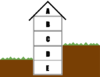
=== Building === (EN only)
==== Accommodation ==== (EN only)
==== Commercial ==== (EN only)
==== Religious ==== (EN only)
==== Civic/amenity ==== (EN only)
==== Agricultural/plant production ==== (EN only)
==== Sports ==== (EN only)
==== Storage ==== (EN only)
==== Cars ==== (EN only)
==== Power/technical buildings ==== (EN only)
==== Other buildings ==== (EN only)
==== Additional attributes ==== (EN only)
== Tagged objects distribution == (EN only)
== Maps, that show building types == (EN only)
== Quality Assurance == (EN only)
== Possible tagging mistakes == (EN only)
== See also == (EN only)
== References == (EN only)
=== In other languages === (EN only)
Help - https://wiki.openstreetmap.org/wiki/Wiki_Translation
català - https://wiki.openstreetmap.org/wiki/Ca:Key:building
čeština - https://wiki.openstreetmap.org/wiki/Cs:Key:building
Deutsch - https://wiki.openstreetmap.org/wiki/DE:Key:building
español - https://wiki.openstreetmap.org/wiki/ES:Key:building
italiano - https://wiki.openstreetmap.org/wiki/IT:Key:building
magyar - https://wiki.openstreetmap.org/wiki/Hu:Key:building
Nederlands - https://wiki.openstreetmap.org/wiki/NL:Key:building
norsk - https://wiki.openstreetmap.org/wiki/No:Key:building
polski - https://wiki.openstreetmap.org/wiki/Pl:Key:building
português - https://wiki.openstreetmap.org/wiki/Pt:Key:building
Ελληνικά - https://wiki.openstreetmap.org/wiki/El:Key:building
български - https://wiki.openstreetmap.org/wiki/Bg:Key:building
русский - https://wiki.openstreetmap.org/wiki/RU:Key:building
українська - https://wiki.openstreetmap.org/wiki/Uk:Key:building
پنجابی - https://wiki.openstreetmap.org/wiki/Pnb:Key:building
한국어 - https://wiki.openstreetmap.org/wiki/Ko:Key:building
中文(简体) - https://wiki.openstreetmap.org/wiki/Zh-hans:Key:building
中文(繁體) - https://wiki.openstreetmap.org/wiki/Zh-hant:Key:building
日本語 - https://wiki.openstreetmap.org/wiki/JA:Key:building
粵語 - https://wiki.openstreetmap.org/wiki/Yue:Key:building
Other languages... - #top
v - https://wiki.openstreetmap.org/wiki/Template:KeyDescription
d - https://wiki.openstreetmap.org/wiki/Template_talk:KeyDescription
OSM Carto - https://wiki.openstreetmap.org/wiki/OpenStreetMap_Carto
Buildings - https://wiki.openstreetmap.org/wiki/Buildings
area - https://wiki.openstreetmap.org/wiki/Area
yes - https://wiki.openstreetmap.org/wiki/Tag:entrance%3Dyes
name - https://wiki.openstreetmap.org/wiki/Key:name
building - https://taginfo.openstreetmap.org/keys/building
More details at taginfo - https://taginfo.openstreetmap.org/tags/building%3Doffices
Taginfo - https://wiki.openstreetmap.org/wiki/Taginfo
AD - https://taginfo.geofabrik.de/europe/andorra/keys/building
AT - https://taginfo.geofabrik.de/europe/austria/keys/building
BR - https://taginfo.geofabrik.de/south-america/brazil/keys/building
BY - https://taginfo.geofabrik.de/europe/belarus/keys/building
CH - https://wiki.openstreetmap.org//taginfo.osm.ch/keys/building
CN - https://taginfo.geofabrik.de/asia/china/keys/building
CZ - http://taginfo.openstreetmap.cz/keys/building
DE - https://taginfo.geofabrik.de/europe/germany/keys/building
DK - https://taginfo.geofabrik.de/europe/denmark/keys/building
FI - https://taginfo.geofabrik.de/europe/finland/keys/building
FR - https://wiki.openstreetmap.org//taginfo.openstreetmap.fr/keys/building
GB - http://taginfo.openstreetmap.org.uk/keys/building
GR - https://taginfo.geofabrik.de/europe/greece/keys/building
HU - http://taginfo.openstreetmap.hu/keys/building
IN - https://wiki.openstreetmap.org//taginfo.openstreetmap.in/keys/building
IR - https://taginfo.geofabrik.de/asia/iran/keys/building
IT - https://taginfo.geofabrik.de/europe/italy/keys/building
LI - https://taginfo.geofabrik.de/europe/liechtenstein/keys/building
LU - https://taginfo.geofabrik.de/europe/luxembourg/keys/building
JP - https://taginfo.openstreetmap.jp/keys/building
KP - https://taginfo.geofabrik.de/asia/north-korea/keys/building
KR - https://taginfo.geofabrik.de/asia/south-korea/keys/building
NL - https://taginfo.geofabrik.de/europe/netherlands/keys/building
PL - http://taginfo.openstreetmap.pl/keys/building
PT - https://taginfo.geofabrik.de/europe/portugal/keys/building
RU - https://taginfo.geofabrik.de/russia/keys/building
ES - https://wiki.openstreetmap.org//taginfo.geofabrik.de/europe/spain/keys/building
AR - https://wiki.openstreetmap.org//taginfo.geofabrik.de/south-america/argentina/keys/building
MX - https://wiki.openstreetmap.org//taginfo.geofabrik.de/north-america/mexico/keys/building
CO - https://wiki.openstreetmap.org//taginfo.geofabrik.de/south-america/colombia/keys/building
BO - https://wiki.openstreetmap.org//taginfo.geofabrik.de/south-america/bolivia/keys/building
CL - https://wiki.openstreetmap.org//taginfo.geofabrik.de/south-america/chile/keys/building
EC - https://wiki.openstreetmap.org//taginfo.geofabrik.de/south-america/ecuador/keys/building
PY - https://wiki.openstreetmap.org//taginfo.geofabrik.de/south-america/paraguay/keys/building
PE - https://wiki.openstreetmap.org//taginfo.geofabrik.de/south-america/peru/keys/building
UY - https://wiki.openstreetmap.org//taginfo.geofabrik.de/south-america/uruguay/keys/building
VE - https://wiki.openstreetmap.org//taginfo.geofabrik.de/south-america/venezuela/keys/building
TW - https://taginfo.geofabrik.de/asia/taiwan/keys/building
UA - https://taginfo.geofabrik.de/europe/ukraine/keys/building
US - https://taginfo.geofabrik.de/north-america/us/keys/building
VN - https://taginfo.geofabrik.de/asia/vietnam/keys/building
overpass-turbo - https://overpass-turbo.eu/?template=key&key=building
OSM Tag History - https://taghistory.raifer.tech/#***/building/
building:use - https://wiki.openstreetmap.org/wiki/Key:building:use
hospital - https://wiki.openstreetmap.org/wiki/Tag:amenity%3Dhospital
amenity - https://wiki.openstreetmap.org/wiki/Key:amenity
man_made - https://wiki.openstreetmap.org/wiki/Key:man_made
tourism - https://wiki.openstreetmap.org/wiki/Key:tourism
shop - https://wiki.openstreetmap.org/wiki/Key:shop
supermarket - https://wiki.openstreetmap.org/wiki/Tag:building%3Dsupermarket
apartments - https://wiki.openstreetmap.org/wiki/Tag:building%3Dapartments
barracks - https://wiki.openstreetmap.org/wiki/Tag:building%3Dbarracks
bungalow - https://wiki.openstreetmap.org/wiki/Tag:building%3Dbungalow
cabin - https://en.wikipedia.org/wiki/Cabin
detached - https://wiki.openstreetmap.org/wiki/Tag:building%3Ddetached
annexe - https://wiki.openstreetmap.org/wiki/Tag:building%3Dannexe
dormitory - https://wiki.openstreetmap.org/wiki/Tag:building%3Ddormitory
residential - https://wiki.openstreetmap.org/wiki/Tag:building%3Dresidential
university - https://wiki.openstreetmap.org/wiki/Tag:amenity%3Duniversity
farm - https://wiki.openstreetmap.org/wiki/Tag:building%3Dfarm
farm_auxiliary - https://wiki.openstreetmap.org/wiki/Tag:building%3Dfarm_auxiliary
barn - https://wiki.openstreetmap.org/wiki/Tag:building%3Dbarn
house - https://wiki.openstreetmap.org/wiki/Tag:building%3Dhouse
landuse - https://wiki.openstreetmap.org/wiki/Key:landuse
ger - https://wiki.openstreetmap.org/wiki/Tag:building%3Dger
hotel - https://wiki.openstreetmap.org/wiki/Tag:tourism%3Dhotel
houseboat - https://wiki.openstreetmap.org/wiki/Tag:building%3Dhouseboat
semidetached_house - https://wiki.openstreetmap.org/wiki/Tag:building%3Dsemidetached_house
static_caravan - https://wiki.openstreetmap.org/wiki/Tag:building%3Dstatic_caravan
stilt_house - https://wiki.openstreetmap.org/wiki/Tag:building%3Dstilt_house
terrace - https://wiki.openstreetmap.org/wiki/Tag:building%3Dterrace
tree_house - https://wiki.openstreetmap.org/wiki/Tag:building%3Dtree_house
trullo - https://wiki.openstreetmap.org/wiki/Tag:building%3Dtrullo
commercial - https://wiki.openstreetmap.org/wiki/Tag:landuse%3Dcommercial
industrial - https://wiki.openstreetmap.org/wiki/Tag:landuse%3Dindustrial
kiosk - https://wiki.openstreetmap.org/wiki/Tag:building%3Dkiosk
office - https://wiki.openstreetmap.org/wiki/Key:office
retail - https://wiki.openstreetmap.org/wiki/Tag:landuse%3Dretail
warehouse - https://wiki.openstreetmap.org/wiki/Tag:building%3Dwarehouse
religious - https://wiki.openstreetmap.org/wiki/Tag:landuse%3Dreligious
cathedral - https://wiki.openstreetmap.org/wiki/Tag:building%3Dcathedral
place_of_worship - https://wiki.openstreetmap.org/wiki/Tag:amenity%3Dplace_of_worship
religion - https://wiki.openstreetmap.org/wiki/Key:religion
denomination - https://wiki.openstreetmap.org/wiki/Key:denomination
chapel - https://wiki.openstreetmap.org/wiki/Tag:building%3Dchapel
church - https://wiki.openstreetmap.org/wiki/Tag:building%3Dchurch
kingdom_hall - https://wiki.openstreetmap.org/wiki/Tag:building%3Dkingdom_hall
christian - https://wiki.openstreetmap.org/wiki/Tag:religion%3Dchristian
monastery - https://wiki.openstreetmap.org/wiki/Tag:historic%3Dmonastery
historic - https://wiki.openstreetmap.org/wiki/Key:historic
mosque - https://wiki.openstreetmap.org/wiki/Tag:building%3Dmosque
presbytery - https://wiki.openstreetmap.org/wiki/Tag:building%3Dpresbytery
shrine - https://wiki.openstreetmap.org/wiki/Tag:building%3Dshrine
wayside_shrine - https://wiki.openstreetmap.org/wiki/Tag:historic%3Dwayside_shrine
synagogue - https://wiki.openstreetmap.org/wiki/Tag:building%3Dsynagogue
temple - https://wiki.openstreetmap.org/wiki/Tag:building%3Dtemple
bakehouse - https://wiki.openstreetmap.org/wiki/Tag:building%3Dbakehouse
baking_oven - https://wiki.openstreetmap.org/wiki/Tag:amenity%3Dbaking_oven
oven - https://wiki.openstreetmap.org/wiki/Key:oven
bridge - https://wiki.openstreetmap.org/wiki/Tag:man_made%3Dbridge
gatehouse - https://wiki.openstreetmap.org/wiki/Tag:building%3Dgatehouse
highway - https://wiki.openstreetmap.org/wiki/Key:highway
civic - https://wiki.openstreetmap.org/wiki/Tag:building%3Dcivic
community_centre - https://wiki.openstreetmap.org/wiki/Tag:amenity%3Dcommunity_centre
toilets - https://wiki.openstreetmap.org/wiki/Tag:building%3Dtoilets
leisure - https://wiki.openstreetmap.org/wiki/Key:leisure
sports_centre - https://wiki.openstreetmap.org/wiki/Tag:building%3Dsports_centre
public - https://wiki.openstreetmap.org/wiki/Tag:building%3Dpublic
clock_tower - https://wiki.openstreetmap.org/wiki/Tag:building%3Dclock_tower
college - https://wiki.openstreetmap.org/wiki/Tag:amenity%3Dcollege
fire_station - https://wiki.openstreetmap.org/wiki/Tag:amenity%3Dfire_station
government - https://wiki.openstreetmap.org/wiki/Tag:building%3Dgovernment
kindergarten - https://wiki.openstreetmap.org/wiki/Tag:amenity%3Dkindergarten
museum - https://wiki.openstreetmap.org/wiki/Tag:building%3Dmuseum
school - https://wiki.openstreetmap.org/wiki/Tag:amenity%3Dschool
train_station - https://wiki.openstreetmap.org/wiki/Tag:building%3Dtrain_station
transportation - https://wiki.openstreetmap.org/wiki/Tag:building%3Dtransportation
public_transport - https://wiki.openstreetmap.org/wiki/Key:public_transport
station - https://wiki.openstreetmap.org/wiki/Tag:public_transport%3Dstation
conservatory - https://wiki.openstreetmap.org/wiki/Tag:building%3Dconservatory
cowshed - https://wiki.openstreetmap.org/wiki/Tag:building%3Dcowshed
greenhouse - https://en.wikipedia.org/wiki/Greenhouse
greenhouse_horticulture - https://wiki.openstreetmap.org/wiki/Tag:landuse%3Dgreenhouse_horticulture
slurry_tank - https://wiki.openstreetmap.org/wiki/Tag:building%3Dslurry_tank
stable - https://wiki.openstreetmap.org/wiki/Tag:building%3Dstable
sty - https://en.wikipedia.org/wiki/Sty
livestock - https://wiki.openstreetmap.org/wiki/Tag:building%3Dlivestock
grandstand - https://wiki.openstreetmap.org/wiki/Tag:building%3Dgrandstand
Pavilion - https://en.wikipedia.org/wiki/Pavilion
riding_hall - https://wiki.openstreetmap.org/wiki/Tag:building%3Driding_hall
sports_hall - https://wiki.openstreetmap.org/wiki/Tag:building%3Dsports_hall
stadium - https://wiki.openstreetmap.org/wiki/Tag:building%3Dstadium
allotment_house - https://wiki.openstreetmap.org/wiki/Tag:building%3Dallotment_house
boathouse - https://wiki.openstreetmap.org/wiki/Tag:building%3Dboathouse
hangar - https://wiki.openstreetmap.org/wiki/Tag:building%3Dhangar
aeroway - https://wiki.openstreetmap.org/wiki/Key:aeroway
hut - https://en.wikipedia.org/wiki/Hut
shed - https://en.wikipedia.org/wiki/Shed
carport - https://en.wikipedia.org/wiki/carport
garage - https://en.wikipedia.org/wiki/Garage_(house)
garages - https://wiki.openstreetmap.org/wiki/Tag:building%3Dgarages
parking - https://wiki.openstreetmap.org/wiki/Tag:building%3Dparking
digester - https://wiki.openstreetmap.org/wiki/Tag:building%3Ddigester
service - https://wiki.openstreetmap.org/wiki/Tag:entrance%3Dservice
tech_cab - https://wiki.openstreetmap.org/wiki/Tag:building%3Dtech_cab
transformer_tower - https://wiki.openstreetmap.org/wiki/Tag:building%3Dtransformer_tower
power - https://wiki.openstreetmap.org/wiki/Key:power
substation - https://wiki.openstreetmap.org/wiki/Key:substation
water_tower - https://wiki.openstreetmap.org/wiki/Tag:building%3Dwater_tower
storage_tank - https://wiki.openstreetmap.org/wiki/Tag:building%3Dstorage_tank
silo - https://wiki.openstreetmap.org/wiki/Tag:building%3Dsilo
beach_hut - https://wiki.openstreetmap.org/wiki/Tag:building%3Dbeach_hut
bunker - https://wiki.openstreetmap.org/wiki/Tag:military%3Dbunker
military - https://wiki.openstreetmap.org/wiki/Key:military
castle - https://wiki.openstreetmap.org/wiki/Tag:historic%3Dcastle
castle_type - https://wiki.openstreetmap.org/wiki/Key:castle_type
construction - https://wiki.openstreetmap.org/wiki/Key:construction
container - https://wiki.openstreetmap.org/wiki/Tag:building%3Dcontainer
guardhouse - https://wiki.openstreetmap.org/wiki/Tag:building%3Dguardhouse
outbuilding - https://wiki.openstreetmap.org/wiki/Tag:building%3Doutbuilding
pagoda - https://wiki.openstreetmap.org/wiki/Tag:building%3Dpagoda
quonset_hut - https://wiki.openstreetmap.org/wiki/Uk:Tag:building%3Dquonset_hut
roof - https://wiki.openstreetmap.org/wiki/Tag:building%3Droof
ruins - https://wiki.openstreetmap.org/wiki/Tag:building%3Druins
ship - https://wiki.openstreetmap.org/wiki/Tag:building%3Dship
tent - https://wiki.openstreetmap.org/wiki/Tag:building%3Dtent
tower - https://wiki.openstreetmap.org/wiki/Tag:building%3Dtower
triumphal_arch - https://wiki.openstreetmap.org/wiki/Tag:building%3Dtriumphal_arch
windmill - https://wiki.openstreetmap.org/wiki/Tag:building%3Dwindmill
user defined - https://wiki.openstreetmap.org/wiki/Proposed_features
building:architecture - https://wiki.openstreetmap.org/wiki/Key:building:architecture
building:colour - https://wiki.openstreetmap.org/wiki/Key:building:colour
building:fireproof - https://wiki.openstreetmap.org/wiki/Key:building:fireproof
building:flats - https://wiki.openstreetmap.org/wiki/Key:building:flats
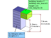
building:levels - https://wiki.openstreetmap.org/wiki/Key:building:levels
building:material - https://wiki.openstreetmap.org/wiki/Key:building:material
building:min_level - https://wiki.openstreetmap.org/wiki/Key:building:min_level
building:part - https://wiki.openstreetmap.org/wiki/Key:building:part
building:soft_storey - https://wiki.openstreetmap.org/wiki/Key:building:soft_storey
construction_date - https://wiki.openstreetmap.org/wiki/Key:construction_date
entrance - https://wiki.openstreetmap.org/wiki/Tag:building%3Dentrance
main - https://wiki.openstreetmap.org/wiki/Tag:entrance%3Dmain
exit - https://wiki.openstreetmap.org/wiki/Tag:entrance%3Dexit
emergency - https://wiki.openstreetmap.org/wiki/Tag:entrance%3Demergency
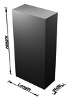
height - https://wiki.openstreetmap.org/wiki/Key:height
max_level - https://wiki.openstreetmap.org/wiki/Key:max_level
Simple Indoor Tagging - https://wiki.openstreetmap.org/wiki/Simple_Indoor_Tagging
min_level - https://wiki.openstreetmap.org/wiki/Key:min_level
non_existent_levels - https://wiki.openstreetmap.org/wiki/Key:non_existent_levels
start_date - https://wiki.openstreetmap.org/wiki/Key:start_date
Editable here - https://wiki.openstreetmap.org/wiki/Template:Building_typology
map - https://osmose.openstreetmap.fr/en/map/#item=0000&level=1%2C2%2C3
français - https://wiki.openstreetmap.org/wiki/FR:Key:building (EN only)
elements - https://wiki.openstreetmap.org/wiki/Elements (EN only)
181 - https://wiki.openstreetmap.org/wiki/Category:Tag_descriptions_for_key_%22building%22 (EN only)
addr:* - https://wiki.openstreetmap.org/wiki/Key:addr:* (EN only)
Status: - https://wiki.openstreetmap.org/wiki/Tag_status#Status_values (EN only)
1How to map - #How_to_map (EN only)
2Usage - #Usage (EN only)
3Values - #Values (EN only)
3.1Building - #Building (EN only)
3.1.1Accommodation - #Accommodation (EN only)
3.1.2Commercial - #Commercial (EN only)
3.1.3Religious - #Religious (EN only)
3.1.4Civic/amenity - #Civic/amenity (EN only)
3.1.5Agricultural/plant production - #Agricultural/plant_production (EN only)
3.1.6Sports - #Sports (EN only)
3.1.7Storage - #Storage (EN only)
3.1.8Cars - #Cars (EN only)
3.1.9Power/technical buildings - #Power/technical_buildings (EN only)
3.1.10Other buildings - #Other_buildings (EN only)
3.1.11Additional attributes - #Additional_attributes (EN only)
4Tagged objects distribution - #Tagged_objects_distribution (EN only)
5Maps, that show building types - #Maps,_that_show_building_types (EN only)
6Quality Assurance - #Quality_Assurance (EN only)
7Possible tagging mistakes - #Possible_tagging_mistakes (EN only)
8See also - #See_also (EN only)
9References - #References (EN only)
node - https://wiki.openstreetmap.org/wiki/Node (EN only)
[1] - #cite_note-1 (EN only)
farmyard - https://wiki.openstreetmap.org/wiki/Tag:landuse%3Dfarmyard (EN only)
party wall - https://en.wikipedia.org/wiki/party_wall (EN only)
works - https://wiki.openstreetmap.org/wiki/Tag:man_made%3Dworks (EN only)
Kingdom Hall - https://en.wikipedia.org/wiki/en:Kingdom_Hall (EN only)
library - https://wiki.openstreetmap.org/wiki/Tag:building%3Dlibrary (EN only)
swimming_pool - https://wiki.openstreetmap.org/wiki/Tag:leisure%3Dswimming_pool (EN only)
townhall - https://wiki.openstreetmap.org/wiki/Tag:amenity%3Dtownhall (EN only)
two meanings - https://en.wiktionary.org/wiki/hut#Noun (EN only)
minor_distribution - https://wiki.openstreetmap.org/wiki/Tag:substation%3Dminor_distribution (EN only)
lifecycle tagging - https://wiki.openstreetmap.org/wiki/Comparison_of_life_cycle_concepts (EN only)
All commonly used values - https://wiki.openstreetmap.org//taginfo.openstreetmap.org/keys/building#values (EN only)
Simple 3D Buildings - https://wiki.openstreetmap.org/wiki/Simple_3D_Buildings (EN only)
OpenStreetBrowser shows building types - https://www.openstreetbrowser.org/#categories=buildings-type (EN only)
Osmose - https://wiki.openstreetmap.org/wiki/Osmose (EN only)
list - https://osmose.openstreetmap.fr/en/issues/open?item=0000 (EN only)
stats - https://osmose.openstreetmap.fr/en/issues/graph.png?item=0000 (EN only)
MapRoulette - https://wiki.openstreetmap.org/wiki/MapRoulette (EN only)
Fix Intersecting Buildings - https://maproulette.org/browse/challenges?query=Fix%20Intersecting%20Buildings (EN only)
building:type - https://wiki.openstreetmap.org/wiki/Key:building:type (EN only)
places with this tag - https://overpass-turbo.eu/?w=%22building%22%3D%22offices%22+global&R (EN only)
you really know what you are doing - https://wiki.openstreetmap.org/wiki/Automated_Edits_code_of_conduct (EN only)
no - https://wiki.openstreetmap.org/wiki/Tag:building%3Dno (EN only)
yes;house - https://taginfo.openstreetmap.org/tags/building%3Dyes%3Bhouse (EN only)
maybe - https://wiki.openstreetmap.org/wiki/Tag:building%3Dmaybe (EN only)
offices - https://taginfo.openstreetmap.org/tags/building%3Doffices (EN only)
Lifecycle prefix - https://wiki.openstreetmap.org/wiki/Lifecycle_prefix (EN only)
Relation:building - https://wiki.openstreetmap.org/wiki/Relation:building (EN only)
↑ - #cite_ref-1 (EN only)
https://github.com/gravitystorm/openstreetmap-carto/issues/806 - https://github.com/gravitystorm/openstreetmap-carto/issues/806 (EN only)
Related terms - https://wiki.openstreetmap.org/wiki/RelatedTerms (EN only)
https://wiki.openstreetmap.org/w/index.php?title=Key:building&oldid=2864672 - https://wiki.openstreetmap.org/w/index.php?title=Key:building&oldid=2864672 (EN only)